Leeholme Recreation Ground
Leeholme Recreation Ground is located in Leeholme, Bishop Auckland (DL14), and offers Grass Pitches.
| Address | Leeholme Road, Leeholme, Bishop Auckland, DL14 8HH |
| Car Park | Yes |
| Car Park Capacity | 32 |
| Management Type | Community Organisation |
| Management Group | Others |
| Owner Type | Local Authority |
| Owner Group | Local Authority |
| Education Phase | Not applicable |
Facilities
| Accessibility | Sports Club / Community Association |
| Management Type | Community Organisation |
| Changing Rooms | Yes |
| Date Record Checked | 17th Feb 2023 |
| Opening Times | Dawn To Dusk |
Facility specifics
Disabled access
| Disabled Access | Yes |
| Disabled Parking | Yes |
| Finding/Reaching Entrance | Yes |
| Doorways | Yes |
| Disabled Changing Facilities | Yes |
| Activity Areas | Yes |
| Disabled Toilets | Yes |
| Emergency Exits | Yes |
| Closure Date | 19th Sep 2016 |
| Accessibility | Pay and Play |
| Management Type | Not Known |
| Year Built | 2000 |
| Changing Rooms | Yes |
| Date Record Checked | 17th Feb 2023 |
| Opening Times | Detailed Timings |
Facility specifics
| Floodlit | No |
| Overmarked | No |
| Surface Type | Other |
Contact
Disabled access
Disabled access for Leeholme Recreation Ground
| Disabled Access | Yes |
| Disabled Parking | Yes |
| Finding/Reaching Entrance | Yes |
| Doorways | Yes |
| Disabled Changing Facilities | Yes |
| Activity Areas | Yes |
| Disabled Toilets | Yes |
| Emergency Exits | Yes |
Where is Leeholme Recreation Ground?
| Sub Building Name | |
| Building Name | |
| Building Number | 0 |
| Dependent Thoroughfare | |
| Thoroughfare Name | LEEHOLME ROAD |
| Double Dependent Locality | |
| Dependent Locality | LEEHOLME |
| PostTown | BISHOP AUCKLAND |
| Postcode | DL14 8HH |
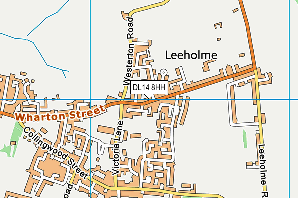
Leeholme Recreation Ground on a map

Leeholme Recreation Ground geodata
| Easting | 424710.14 |
| Northing | 530376.71 |
| Latitude | 54.667866 |
| Longitude | -1.618401 |
| Local Authority Name | County Durham |
| Local Authority Code | E06000047 |
| Parliamentary Constituency Name | Bishop Auckland |
| Parliamentary Constituency Code | E14000569 |
| Region Name | North East |
| Region Code | E15000001 |
| Ward Name | Coundon |
| Ward Code | E05009050 |
| Output Area Code | E00105950 |
About this data
This data is open data sourced from Active Places Power and licenced under the Active Places Open Data Licence.
| Created On | 22nd Aug 2007 |
| Audited On | 17th Feb 2023 |
| Checked On | 17th Feb 2023 |
