Kingsway Golf Course (Closed) - Scunthorpe
Kingsway Golf Course (Closed) is located in Scunthorpe (DN15).
| Address | GOLF COURSE, Kingsway, Scunthorpe, DN15 7ER |
| Car Park | Yes |
| Car Park Capacity | 50 |
| Management Type | Local Authority (in house) |
| Management Group | Local Authority |
| Owner Type | Local Authority |
| Owner Group | Local Authority |
| Education Phase | Not Known |
| Closure Date | 29th Jun 2018 |
| Closure Reason | Strategic Review - facility/site not being replaced |
Aliases
Kingsway Golf Course (Closed) is also known as:
Facilities
| Closure Date | 29th Jun 2018 |
| Closure Reason | Strategic Review - facility/site not being replaced |
| Accessibility | Pay and Play |
| Management Type | Local Authority (in house) |
| Year Built | 1970 |
| Changing Rooms | Yes |
| Date Record Checked | 27th Sep 2019 |
Opening times
| Access description | Pay and Play |
|---|
| Opening time | 07:45 |
| Closing time | 17:30 |
| Period open for | Every day |
Facility specifics
Disabled access
| Disabled Access | Yes |
| Disabled Parking | Yes |
| Finding/Reaching Entrance | Yes |
| Reception Area | Yes |
| Doorways | Yes |
| Disabled Changing Facilities | Yes |
| Activity Areas | Yes |
| Disabled Toilets | Yes |
| Social Areas | Yes |
| Spectator Areas | Yes |
| Emergency Exits | Yes |
Contact
Disabled access
Disabled access for Kingsway Golf Course (Closed)
| Disabled Access | Yes |
| Disabled Parking | Yes |
| Finding/Reaching Entrance | Yes |
| Reception Area | Yes |
| Doorways | Yes |
| Disabled Changing Facilities | Yes |
| Activity Areas | Yes |
| Disabled Toilets | Yes |
| Social Areas | Yes |
| Spectator Areas | Yes |
| Emergency Exits | Yes |
Where is Kingsway Golf Course (Closed)?
| Sub Building Name | |
| Building Name | GOLF COURSE |
| Building Number | 0 |
| Dependent Thoroughfare | |
| Thoroughfare Name | KINGSWAY |
| Double Dependent Locality | |
| Dependent Locality | |
| PostTown | SCUNTHORPE |
| Postcode | DN15 7ER |
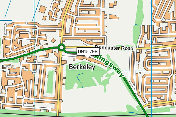
Kingsway Golf Course (Closed) on a map

Kingsway Golf Course (Closed) geodata
| Easting | 487702.22 |
| Northing | 410978.2 |
| Latitude | 53.588061 |
| Longitude | -0.67657 |
| Local Authority Name | North Lincolnshire |
| Local Authority Code | E06000013 |
| Parliamentary Constituency Name | Scunthorpe |
| Parliamentary Constituency Code | E14000914 |
| Region Name | Yorkshire and the Humber |
| Region Code | E15000003 |
| Ward Name | Town |
| Ward Code | E05001744 |
| Output Area Code | E00067281 |
About this data
This data is open data sourced from Active Places Power and licenced under the Active Places Open Data Licence.
| toid | osgb5000005205910643 |
| Created On | 26th Apr 2004 |
| Audited On | 1st Aug 2018 |
| Checked On | 23rd Sep 2019 |
