Kings Physique & Fitness Centre (Closed) - Passfield
Kings Physique & Fitness Centre (Closed) is located in Passfield, Liphook (GU30).
| Address | Unit 1e1, Passfield Mill, Mill Lane, Passfield, Liphook, GU30 7RR |
| Car Park | Yes |
| Car Park Capacity | 100 |
| Management Type | Commercial Management |
| Management Group | Commercial |
| Owner Type | Commercial |
| Owner Group | Commercial |
| Education Phase | Not Known |
| Closure Date | 17th Mar 2017 |
| Closure Reason | Redevelopment - loss due to development project (e.g. major schemes such as HS2, new roads, area regeneration or smaller local development) |
Facilities
| Closure Date | 17th Mar 2017 |
| Closure Reason | Redevelopment - loss due to development project (e.g. major schemes such as HS2, new roads, area regeneration or smaller local development) |
| Accessibility | Pay and Play |
| Management Type | Commercial Management |
| Year Built | 1997 |
| Year Refurbished | 2004 |
| Changing Rooms | Yes |
| Date Record Checked | 17th Mar 2017 |
Opening times
| Access description | Pay and Play |
|---|
| Opening time | 10:00 |
| Closing time | 12:00 |
| Period open for | Saturday |
| |
| Access description | Pay and Play |
|---|
| Opening time | 10:00 |
| Closing time | 13:00 |
| Period open for | Monday-Friday |
| |
| Access description | Pay and Play |
|---|
| Opening time | 15:00 |
| Closing time | 21:00 |
| Period open for | Monday-Friday |
Facility specifics
Contact
Disabled access
Disabled access for Kings Physique & Fitness Centre (Closed)
Where is Kings Physique & Fitness Centre (Closed)?
| Sub Building Name | |
| Building Name | Unit 1e1 |
| Building Number | 0 |
| Dependent Thoroughfare | Passfield Mill |
| Thoroughfare Name | Mill Lane |
| Double Dependent Locality | |
| Dependent Locality | Passfield |
| PostTown | Liphook |
| Postcode | GU30 7RR |
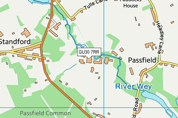
Kings Physique & Fitness Centre (Closed) on a map

Kings Physique & Fitness Centre (Closed) geodata
| Easting | 481904 |
| Northing | 134276 |
| Latitude | 51.101946 |
| Longitude | -0.831601 |
| Local Authority Name | East Hampshire |
| Local Authority Code | E07000085 |
| Parliamentary Constituency Name | East Hampshire |
| Parliamentary Constituency Code | E14000680 |
| Region Name | South East |
| Region Code | E15000008 |
| Ward Name | Bramshott & Liphook |
| Ward Code | E05012299 |
| Output Area Code | E00114826 |
About this data
This data is open data sourced from Active Places Power and licenced under the Active Places Open Data Licence.
| Created On | 18th May 2004 |
| Audited On | 22nd Mar 2016 |
| Checked On | 16th Mar 2017 |
