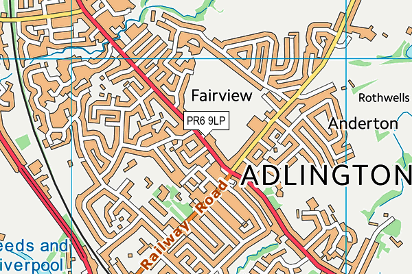
King George V Playing Field (Adlington)
King George V Playing Field (Adlington) is located in Adlington (PR6), and offers Grass Pitches.
| Address | KING GEORGES FIELD PLAY AREA, Chorley Road, Adlington, PR6 9LP |
| Car Park | Yes |
| Car Park Capacity | 15 |
| Management Type | Local Authority (in house) |
| Management Group | Local Authority |
| Owner Type | Local Authority |
| Owner Group | Local Authority |
| Education Phase | Not applicable |
Facilities
| Accessibility | Pay and Play |
| Management Type | Local Authority (in house) |
| Year Built | 1935 |
| Changing Rooms | Yes |
| Year Changing Rooms Refurbished | 2010 |
| Date Record Checked | 9th Sep 2022 |
| Opening Times | Dawn To Dusk |
Facility specifics
| Accessibility | Pay and Play |
| Management Type | Local Authority (in house) |
| Year Built | 1935 |
| Changing Rooms | Yes |
| Year Changing Rooms Refurbished | 2010 |
| Date Record Checked | 9th Sep 2022 |
| Opening Times | Dawn To Dusk |
Facility specifics
| Accessibility | Pay and Play |
| Management Type | Local Authority (in house) |
| Changing Rooms | Yes |
| Date Record Created | 9th May 2017 |
| Date Record Checked | 9th Sep 2022 |
| Opening Times | Dawn To Dusk |
Facility specifics
| Accessibility | Pay and Play |
| Management Type | Local Authority (in house) |
| Year Built | 1935 |
| Changing Rooms | Yes |
| Year Changing Rooms Refurbished | 2010 |
| Date Record Created | 21st May 2020 |
| Date Record Checked | 9th Sep 2022 |
| Opening Times | Dawn To Dusk |
Facility specifics
Contact
Where is King George V Playing Field (Adlington)?
| Sub Building Name | |
| Building Name | KING GEORGES FIELD PLAY AREA |
| Building Number | 0 |
| Dependent Thoroughfare | |
| Thoroughfare Name | CHORLEY ROAD |
| Double Dependent Locality | |
| Dependent Locality | |
| PostTown | ADLINGTON |
| Postcode | PR6 9LP |
King George V Playing Field (Adlington) on a map

King George V Playing Field (Adlington) geodata
| Easting | 360443 |
| Northing | 413821 |
| Latitude | 53.619427 |
| Longitude | -2.599485 |
| Local Authority Name | Chorley |
| Local Authority Code | E07000118 |
| Parliamentary Constituency Name | Chorley |
| Parliamentary Constituency Code | E14000637 |
| Region Name | North West |
| Region Code | E15000002 |
| Ward Name | Adlington & Anderton |
| Ward Code | E05013064 |
| Output Area Code | E00126472 |
About this data
This data is open data sourced from Active Places Power and licenced under the Active Places Open Data Licence.
| toid | osgb1000000221198203 |
| Created On | 25th Feb 2005 |
| Audited On | 9th Sep 2022 |
| Checked On | 9th Sep 2022 |
