Keir Hardie Recreation Ground - Canning Town
Keir Hardie Recreation Ground is located in Canning Town, London (E16), and offers Grass Pitches.
| Address | KEIR HARDIE RECREATION GROUND, Radland Road, Canning Town, London, E16 1LQ |
| Management Type | Local Authority (in house) |
| Management Group | Local Authority |
| Owner Type | Local Authority |
| Owner Group | Local Authority |
| Education Phase | Not applicable |
Facilities
| Accessibility | Free Public Access |
| Management Type | Local Authority (in house) |
| Changing Rooms | No |
| Date Record Created | 10th Nov 2016 |
| Date Record Checked | 6th Sep 2022 |
| Opening Times | Dawn To Dusk |
Facility specifics
Disabled access
| Disabled Access | Yes |
| Activity Areas | Yes |
| Accessibility | Free Public Access |
| Management Type | Local Authority (in house) |
| Changing Rooms | Yes |
| Date Record Created | 17th May 2018 |
| Date Record Checked | 6th Sep 2022 |
| Opening Times | Dawn To Dusk |
Facility specifics
Disabled access
| Disabled Access | Yes |
| Activity Areas | Yes |
Contact
Disabled access
Disabled access for Keir Hardie Recreation Ground
| Disabled Access | Yes |
| Activity Areas | Yes |
Where is Keir Hardie Recreation Ground?
| Sub Building Name | |
| Building Name | KEIR HARDIE RECREATION GROUND |
| Building Number | 0 |
| Dependent Thoroughfare | |
| Thoroughfare Name | RADLAND ROAD |
| Double Dependent Locality | |
| Dependent Locality | CANNING TOWN |
| PostTown | LONDON |
| Postcode | E16 1LQ |
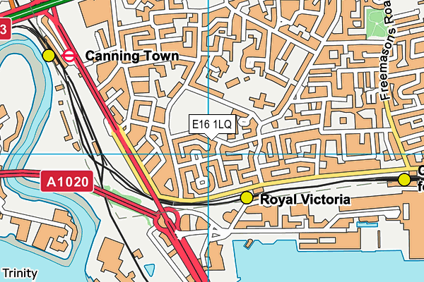
Keir Hardie Recreation Ground on a map

Keir Hardie Recreation Ground geodata
| Easting | 539966 |
| Northing | 181137 |
| Latitude | 51.51183 |
| Longitude | 0.015595 |
| Local Authority Name | Newham |
| Local Authority Code | E09000025 |
| Parliamentary Constituency Name | West Ham |
| Parliamentary Constituency Code | E14001032 |
| Region Name | London |
| Region Code | E15000007 |
| Ward Name | Canning Town South |
| Ward Code | E05013907 |
| Output Area Code | E00175045 |
About this data
This data is open data sourced from Active Places Power and licenced under the Active Places Open Data Licence.
| toid | osgb5000005102201114 |
| Created On | 10th Nov 2016 |
| Audited On | 6th Sep 2022 |
| Checked On | 6th Sep 2022 |
