Jim Play - Loughborough
Jim Play is located in Loughborough (LE11), and offers Health and Fitness Gym.
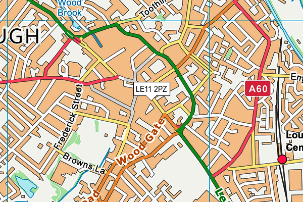
| Address | 32, High Street, Loughborough, LE11 2PZ |
| Management Type | Commercial Management |
| Management Group | Commercial |
| Owner Type | Commercial |
| Owner Group | Commercial |
| Education Phase | Not applicable |
Facilities
| Accessibility | Registered Membership use |
| Management Type | Commercial Management |
| Year Built | 2014 |
| Changing Rooms | Yes |
| Date Record Checked | 21st Feb 2023 |
Opening times
| Access description | Registered Membership use |
|---|
| Opening time | 08:00 |
| Closing time | 18:00 |
| Period open for | Weekend |
| |
| Access description | Registered Membership use |
|---|
| Opening time | 06:30 |
| Closing time | 22:00 |
| Period open for | Monday-Friday |
Facility specifics
Disabled access
| Disabled Access | Yes |
| Finding/Reaching Entrance | Yes |
| Reception Area | Yes |
| Doorways | Yes |
| Disabled Changing Facilities | Yes |
| Activity Areas | Yes |
| Disabled Toilets | Yes |
| Social Areas | Yes |
| Spectator Areas | Yes |
| Emergency Exits | Yes |
Contact
Disabled access
Disabled access for Jim Play
| Disabled Access | Yes |
| Finding/Reaching Entrance | Yes |
| Reception Area | Yes |
| Doorways | Yes |
| Disabled Changing Facilities | Yes |
| Activity Areas | Yes |
| Disabled Toilets | Yes |
| Social Areas | Yes |
| Spectator Areas | Yes |
| Emergency Exits | Yes |
Where is Jim Play?
| Sub Building Name | |
| Building Name | |
| Building Number | 32 |
| Dependent Thoroughfare | |
| Thoroughfare Name | High Street |
| Double Dependent Locality | |
| Dependent Locality | |
| PostTown | Loughborough |
| Postcode | LE11 2PZ |
Jim Play on a map

Jim Play geodata
| Easting | 453707.55 |
| Northing | 319606.79 |
| Latitude | 52.771391 |
| Longitude | -1.205368 |
| Local Authority Name | Charnwood |
| Local Authority Code | E07000130 |
| Parliamentary Constituency Name | Loughborough |
| Parliamentary Constituency Code | E14000797 |
| Region Name | East Midlands |
| Region Code | E15000004 |
| Ward Name | Loughborough Southfields |
| Ward Code | E05005440 |
| Output Area Code | E00130502 |
About this data
This data is open data sourced from Active Places Power and licenced under the Active Places Open Data Licence.
| Created On | 20th Jul 2015 |
| Audited On | 21st Feb 2023 |
| Checked On | 21st Feb 2023 |
