Islamia Girl's High School (Closed) - Huddersfield
Islamia Girl's High School (Closed) is located in Huddersfield (HD1).
| Address | 34, Thornton Lodge Road, Huddersfield, HD1 3JQ |
| Management Type | School/College/University (in house) |
| Management Group | Education |
| Owner Type | Other Independent School |
| Owner Group | Education |
| Education Phase | Secondary |
| Closure Date | 22nd Jul 2018 |
| Closure Reason | Strategic Review - facility/site not being replaced |
Facilities
| Closure Date | 22nd Jul 2018 |
| Closure Reason | Strategic Review - facility/site not being replaced |
| Accessibility | Private Use |
| Management Type | School/College/University (in house) |
| Year Built | 1984 |
| Changing Rooms | Yes |
| Date Record Checked | 11th Oct 2021 |
Opening times
| Access description | Private Use |
|---|
| Opening time | 08:00 |
| Closing time | 17:00 |
| Period open for | Monday-Friday |
Facility specifics
| Area | 180m² |
| Floor Matting | Don't Know |
| Gymnastics Trampoline Use | Don't Know |
| Length | 18m |
| Moveable Balance Apparatus | Don't Know |
| Moveable Large Apparatus | Don't Know |
| Moveable Rebound Apparatus | Don't Know |
| Moveable Trampolines | Don't Know |
| Width | 10m |
| Small Apparatus | Don't Know |
| Swinging and Hanging Apparatus | Don't Know |
Contact
Where is Islamia Girl's High School (Closed)?
| Sub Building Name | |
| Building Name | |
| Building Number | 34 |
| Dependent Thoroughfare | |
| Thoroughfare Name | Thornton Lodge Road |
| Double Dependent Locality | |
| Dependent Locality | |
| PostTown | Huddersfield |
| Postcode | HD1 3JQ |
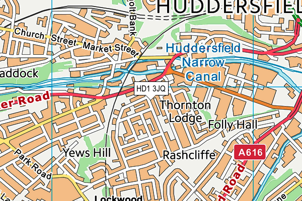
Islamia Girl's High School (Closed) on a map

Islamia Girl's High School (Closed) geodata
| Easting | 413469 |
| Northing | 415855 |
| Latitude | 53.639041 |
| Longitude | -1.797761 |
| Local Authority Name | Kirklees |
| Local Authority Code | E08000034 |
| Parliamentary Constituency Name | Colne Valley |
| Parliamentary Constituency Code | E14000645 |
| Region Name | Yorkshire and the Humber |
| Region Code | E15000003 |
| Ward Name | Crosland Moor and Netherton |
| Ward Code | E05008560 |
| Output Area Code | E00055876 |
About this data
This data is open data sourced from Active Places Power and licenced under the Active Places Open Data Licence.
| Created On | 27th Jul 2004 |
| Audited On | 30th Sep 2009 |
| Checked On | 13th Aug 2020 |
