Ironmasters Gym (Closed) - Mitcheldean
Ironmasters Gym (Closed) is located in Mitcheldean (GL17).
| Address | Building 6/2, Vantage Point Business Village, Mitcheldean, GL17 0DD |
| Car Park | Yes |
| Car Park Capacity | 100 |
| Management Type | Commercial Management |
| Management Group | Commercial |
| Owner Type | Commercial |
| Owner Group | Commercial |
| Education Phase | Not applicable |
| Closure Date | 12th Sep 2017 |
| Closure Reason | Strategic Review - facility/site to be replaced at another site |
Facilities
| Closure Date | 12th Sep 2017 |
| Closure Reason | Strategic Review - facility/site to be replaced at another site |
| Accessibility | Pay and Play |
| Management Type | Commercial Management |
| Year Built | 2000 |
| Changing Rooms | Yes |
| Date Record Checked | 12th Sep 2017 |
Opening times
| Access description | Pay and Play |
|---|
| Opening time | 10:00 |
| Closing time | 14:00 |
| Period open for | Weekend |
| |
| Access description | Pay and Play |
|---|
| Opening time | 08:00 |
| Closing time | 22:00 |
| Period open for | Monday-Friday |
Facility specifics
Disabled access
| Disabled Access | Yes |
| Disabled Parking | Yes |
| Finding/Reaching Entrance | Yes |
| Reception Area | Yes |
| Doorways | Yes |
| Disabled Changing Facilities | Yes |
| Activity Areas | Yes |
| Disabled Toilets | Yes |
| Emergency Exits | Yes |
Contact
Disabled access
Disabled access for Ironmasters Gym (Closed)
| Disabled Access | Yes |
| Disabled Parking | Yes |
| Finding/Reaching Entrance | Yes |
| Reception Area | Yes |
| Doorways | Yes |
| Disabled Changing Facilities | Yes |
| Activity Areas | Yes |
| Disabled Toilets | Yes |
| Emergency Exits | Yes |
Where is Ironmasters Gym (Closed)?
| Sub Building Name | |
| Building Name | Building 6/2 |
| Building Number | 0 |
| Dependent Thoroughfare | |
| Thoroughfare Name | Vantage Point Business Village |
| Double Dependent Locality | |
| Dependent Locality | |
| PostTown | Mitcheldean |
| Postcode | GL17 0DD |
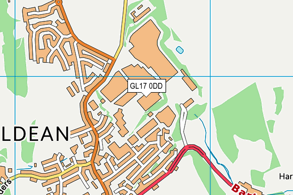
Ironmasters Gym (Closed) on a map

Ironmasters Gym (Closed) geodata
| Easting | 366573.6 |
| Northing | 218881.05 |
| Latitude | 51.867497 |
| Longitude | -2.486867 |
| Local Authority Name | Forest of Dean |
| Local Authority Code | E07000080 |
| Parliamentary Constituency Name | Forest of Dean |
| Parliamentary Constituency Code | E14000705 |
| Region Name | South West |
| Region Code | E15000009 |
| Ward Name | Mitcheldean, Ruardean & Drybrook |
| Ward Code | E05012168 |
| Output Area Code | E00113157 |
About this data
This data is open data sourced from Active Places Power and licenced under the Active Places Open Data Licence.
| Created On | 21st Aug 2014 |
| Audited On | 13th Sep 2016 |
| Checked On | 11th Sep 2017 |
