Homer Hill Recreation Ground - Halesowen
Homer Hill Recreation Ground is located in Halesowen (B63), and offers Grass Pitches.
| Address | Slade Road, Halesowen, B63 2UR |
| Management Type | Local Authority (in house) |
| Management Group | Local Authority |
| Owner Type | Local Authority |
| Owner Group | Local Authority |
| Education Phase | Not applicable |
Facilities
| Accessibility | Pay and Play |
| Management Type | Local Authority (in house) |
| Changing Rooms | Yes |
| Date Record Checked | 6th Oct 2022 |
| Opening Times | Dawn To Dusk |
Facility specifics
| Accessibility | Pay and Play |
| Management Type | Local Authority (in house) |
| Changing Rooms | Yes |
| Date Record Checked | 6th Oct 2022 |
| Opening Times | Dawn To Dusk |
Facility specifics
| Accessibility | Pay and Play |
| Management Type | Local Authority (in house) |
| Changing Rooms | Yes |
| Date Record Checked | 6th Oct 2022 |
| Opening Times | Dawn To Dusk |
Facility specifics
| Accessibility | Pay and Play |
| Management Type | Local Authority (in house) |
| Changing Rooms | Yes |
| Date Record Created | 21st May 2020 |
| Date Record Checked | 6th Oct 2022 |
| Opening Times | Dawn To Dusk |
Facility specifics
Contact
Where is Homer Hill Recreation Ground?
| Sub Building Name | |
| Building Name | |
| Building Number | 0 |
| Dependent Thoroughfare | |
| Thoroughfare Name | Slade Road |
| Double Dependent Locality | |
| Dependent Locality | |
| PostTown | Halesowen |
| Postcode | B63 2UR |
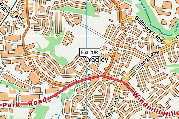
Homer Hill Recreation Ground on a map

Homer Hill Recreation Ground geodata
| Easting | 394023.16 |
| Northing | 284932.04 |
| Latitude | 52.462299 |
| Longitude | -2.089396 |
| Local Authority Name | Dudley |
| Local Authority Code | E08000027 |
| Parliamentary Constituency Name | Stourbridge |
| Parliamentary Constituency Code | E14000976 |
| Region Name | West Midlands |
| Region Code | E15000005 |
| Ward Name | Cradley and Wollescote |
| Ward Code | E05001242 |
| Output Area Code | E00049922 |
About this data
This data is open data sourced from Active Places Power and licenced under the Active Places Open Data Licence.
| Created On | 13th May 2008 |
| Audited On | 6th Oct 2022 |
| Checked On | 6th Oct 2022 |
