Hollingwood Primary School (Closed)
Hollingwood Primary School (Closed) is located in Hollingwood, Chesterfield (S43).
| Address | Lilac Street, Hollingwood, Chesterfield, S43 2JG |
| Car Park | Yes |
| Car Park Capacity | 12 |
| Management Type | School/College/University (in house) |
| Management Group | Education |
| Owner Type | Community school |
| Owner Group | Education |
| Education Phase | Primary |
| Closure Date | 1st Nov 2010 |
| Closure Reason | Unclassified |
Facilities
| Closure Date | 1st Nov 2010 |
| Closure Reason | Unclassified |
| Accessibility | Private Use |
| Management Type | Not Known |
| Year Built | 1930 |
| Date Record Checked | 7th Oct 2011 |
| Opening Times | Detailed Timings |
Facility specifics
Contact
Disabled access
Disabled access for Hollingwood Primary School (Closed)
| Notes | No designated parking, but spaces are right by the school. |
Where is Hollingwood Primary School (Closed)?
| Sub Building Name | |
| Building Name | |
| Building Number | 0 |
| Dependent Thoroughfare | |
| Thoroughfare Name | Lilac Street |
| Double Dependent Locality | |
| Dependent Locality | Hollingwood |
| PostTown | Chesterfield |
| Postcode | S43 2JG |
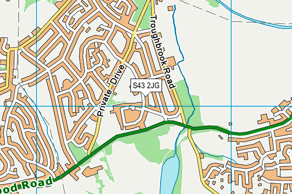
Hollingwood Primary School (Closed) on a map

Hollingwood Primary School (Closed) geodata
| Easting | 441462 |
| Northing | 374066 |
| Latitude | 53.261981 |
| Longitude | -1.379887 |
| Local Authority Name | Chesterfield |
| Local Authority Code | E07000034 |
| Parliamentary Constituency Name | Chesterfield |
| Parliamentary Constituency Code | E14000632 |
| Region Name | East Midlands |
| Region Code | E15000004 |
| Ward Name | Hollingwood and Inkersall |
| Ward Code | E05003329 |
| Output Area Code | E00098871 |
About this data
This data is open data sourced from Active Places Power and licenced under the Active Places Open Data Licence.
| Created On | 13th Oct 2006 |
| Audited On | 26th Jan 2015 |
| Checked On | 7th Oct 2011 |
