Highwayman (Closed) - Oswestry
Highwayman (Closed) is located in Oswestry (SY11).
| Address | Oswestry, SY11 2RT |
| Car Park | Yes |
| Car Park Capacity | 30 |
| Management Type | School/College/University (in house) |
| Management Group | Education |
| Owner Type | Community Organisation |
| Owner Group | Community Organisation |
| Education Phase | Not Known |
| Closure Date | 1st Jan 2004 |
| Closure Reason | Unclassified |
Facilities
| Closure Date | 1st Jan 2004 |
| Closure Reason | Unclassified |
| Accessibility | Pay and Play |
| Management Type | Not Known |
| Changing Rooms | No |
| Date Record Checked | 29th May 2009 |
| Opening Times | Detailed Timings |
Facility specifics
Where is Highwayman (Closed)?
| Sub Building Name | |
| Building Name | |
| Building Number | 0 |
| Dependent Thoroughfare | |
| Thoroughfare Name | |
| Double Dependent Locality | |
| Dependent Locality | |
| PostTown | Oswestry |
| Postcode | SY11 2RT |
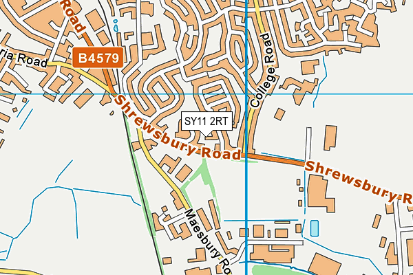
Highwayman (Closed) on a map

Highwayman (Closed) geodata
| Easting | 329737 |
| Northing | 328765 |
| Latitude | 52.851778 |
| Longitude | -3.044835 |
| Local Authority Name | Shropshire |
| Local Authority Code | E06000051 |
| Parliamentary Constituency Name | North Shropshire |
| Parliamentary Constituency Code | E14000849 |
| Region Name | West Midlands |
| Region Code | E15000005 |
| Ward Name | Oswestry East |
| Ward Code | E05009282 |
| Output Area Code | E00147198 |
About this data
This data is open data sourced from Active Places Power and licenced under the Active Places Open Data Licence.
| Created On | 16th Nov 2006 |
| Audited On | 26th Jan 2015 |
| Checked On | 29th May 2009 |
