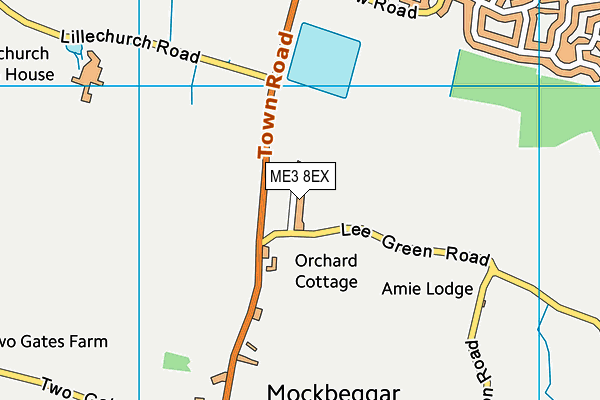
Higham & Mockbeggar Cricket Club (Closed) - Cliffe Woods
Higham & Mockbeggar Cricket Club (Closed) is located in Cliffe Woods, Rochester (ME3).
| Address | HIGHAM MOCKBEGGAR CRICKET CLUB, Lee Green Road, Cliffe Woods, Rochester, ME3 8EX |
| Car Park | Yes |
| Car Park Capacity | 20 |
| Management Type | Sport Club |
| Management Group | Others |
| Owner Type | Commercial |
| Owner Group | Commercial |
| Education Phase | Not Known |
| Closure Date | 1st Jul 2018 |
| Closure Reason | Strategic Review - facility/site not being replaced |
Aliases
Higham & Mockbeggar Cricket Club (Closed) is also known as:
Facilities
| Closure Date | 1st Jul 2018 |
| Closure Reason | Strategic Review - facility/site not being replaced |
| Accessibility | Sports Club / Community Association |
| Management Type | Sport Club |
| Year Built | 1961 |
| Year Refurbished | 2011 |
| Changing Rooms | Yes |
| Year Changing Rooms Refurbished | 2006 |
| Date Record Checked | 2nd Jan 2020 |
| Opening Times | Dawn To Dusk |
Facility specifics
Contact
Disabled access
Disabled access for Higham & Mockbeggar Cricket Club (Closed)
| Notes | Ground / Pavilion and Facilities are accessible with moderate support. |
Where is Higham & Mockbeggar Cricket Club (Closed)?
| Sub Building Name | |
| Building Name | HIGHAM MOCKBEGGAR CRICKET CLUB |
| Building Number | 0 |
| Dependent Thoroughfare | |
| Thoroughfare Name | LEE GREEN ROAD |
| Double Dependent Locality | |
| Dependent Locality | CLIFFE WOODS |
| PostTown | ROCHESTER |
| Postcode | ME3 8EX |
Higham & Mockbeggar Cricket Club (Closed) on a map

Higham & Mockbeggar Cricket Club (Closed) geodata
| Easting | 573490.09 |
| Northing | 172795.68 |
| Latitude | 51.42761 |
| Longitude | 0.494159 |
| Local Authority Name | Medway |
| Local Authority Code | E06000035 |
| Parliamentary Constituency Name | Rochester and Strood |
| Parliamentary Constituency Code | E14000898 |
| Region Name | South East |
| Region Code | E15000008 |
| Ward Name | Strood Rural |
| Ward Code | E05002266 |
| Output Area Code | E00081603 |
About this data
This data is open data sourced from Active Places Power and licenced under the Active Places Open Data Licence.
| Created On | 6th Dec 2009 |
| Audited On | 1st Aug 2018 |
| Checked On | 30th Dec 2019 |
