High Adventure Outdoor Education Centre (Closed) - Cowling
High Adventure Outdoor Education Centre (Closed) is located in Cowling, Keighley (BD22).
| Address | Keighley Road, Cowling, Keighley, BD22 0AA |
| Car Park | Yes |
| Car Park Capacity | 4 |
| Management Type | Not Known |
| Management Group | Not Known |
| Owner Type | Commercial |
| Owner Group | Commercial |
| Education Phase | Not Known |
| Closure Date | 1st Jul 2005 |
| Closure Reason | Unclassified |
Facilities
| Closure Date | 1st Jul 2005 |
| Closure Reason | Unclassified |
| Accessibility | Pay and Play |
| Management Type | Not Known |
| Year Built | 2001 |
| Changing Rooms | Yes |
| Date Record Checked | 21st Apr 2006 |
| Opening Times | Detailed Timings |
Facility specifics
| Access to Pool Hoist | No |
| Area | 66m² |
| Diving Boards | No |
| Length | 11m |
| Maximum Depth | 1.83m |
| Minimum Depth | 1.06m |
| Movable Floor | No |
| Width | 6m |
Disabled access
Disabled access for High Adventure Outdoor Education Centre (Closed)
| Disabled Access | Yes |
| Finding/Reaching Entrance | Yes |
| Reception Area | Yes |
| Doorways | Yes |
| Disabled Changing Facilities | Yes |
| Activity Areas | Yes |
| Disabled Toilets | Yes |
| Emergency Exits | Yes |
| Notes | Finding/Reaching Entrance: Ramps, Signposts, Reception Area: Ramps, Emergency Exits: Ramps |
Where is High Adventure Outdoor Education Centre (Closed)?
| Sub Building Name | |
| Building Name | |
| Building Number | 0 |
| Dependent Thoroughfare | |
| Thoroughfare Name | Keighley Road |
| Double Dependent Locality | |
| Dependent Locality | Cowling |
| PostTown | Keighley |
| Postcode | BD22 0AA |
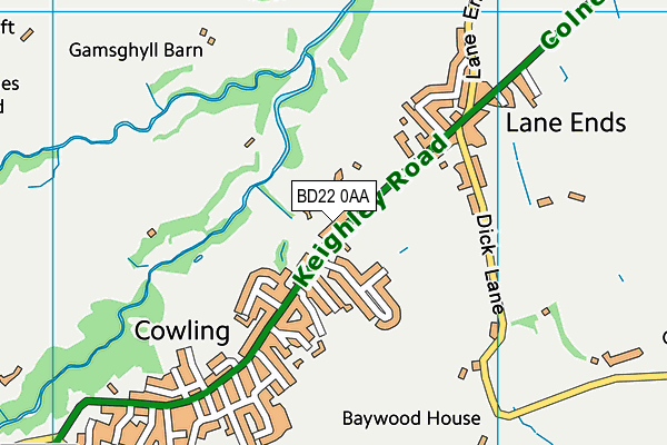
High Adventure Outdoor Education Centre (Closed) on a map

High Adventure Outdoor Education Centre (Closed) geodata
| Easting | 397626.3 |
| Northing | 443600.2 |
| Latitude | 53.888579 |
| Longitude | -2.0376 |
| Local Authority Name | Craven |
| Local Authority Code | E07000163 |
| Parliamentary Constituency Name | Skipton and Ripon |
| Parliamentary Constituency Code | E14000928 |
| Region Name | Yorkshire and the Humber |
| Region Code | E15000003 |
| Ward Name | Cowling |
| Ward Code | E05010776 |
| Output Area Code | E00140288 |
About this data
This data is open data sourced from Active Places Power and licenced under the Active Places Open Data Licence.
| Created On | 14th Dec 2014 |
| Audited On | 26th Jan 2015 |
| Checked On | 21st Apr 2006 |
