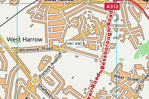
Harrow School (Philathletic Ground)
Harrow School (Philathletic Ground) is located in Harrow (HA1), and offers Grass Pitches.
| Address | Whitmore Road, Harrow, HA1 4AD |
| Management Type | School/College/University (in house) |
| Management Group | Education |
| Owner Type | Other Independent School |
| Owner Group | Education |
| Education Phase | Secondary |
Facilities
| Accessibility | Private Use |
| Management Type | School/College/University (in house) |
| Changing Rooms | Yes |
| Date Record Created | 6th Sep 2017 |
| Date Record Checked | 2nd Jun 2023 |
| Opening Times | Dawn To Dusk |
Facility specifics
Disabled access
| Disabled Access | Yes |
| Activity Areas | Yes |
| Accessibility | Sports Club / Community Association |
| Management Type | School/College/University (in house) |
| Changing Rooms | Yes |
| Date Record Created | 6th Sep 2017 |
| Date Record Checked | 2nd Jun 2023 |
| Opening Times | Dawn To Dusk |
Facility specifics
Disabled access
| Disabled Access | Yes |
| Activity Areas | Yes |
Contact
Disabled access
Disabled access for Harrow School (Philathletic Ground)
| Disabled Access | Yes |
| Activity Areas | Yes |
Where is Harrow School (Philathletic Ground)?
| Sub Building Name | |
| Building Name | |
| Building Number | 0 |
| Dependent Thoroughfare | |
| Thoroughfare Name | WHITMORE ROAD |
| Double Dependent Locality | |
| Dependent Locality | |
| PostTown | HARROW |
| Postcode | HA1 4AD |
Harrow School (Philathletic Ground) on a map

Harrow School (Philathletic Ground) geodata
| Easting | 514598.36 |
| Northing | 187462.11 |
| Latitude | 51.574388 |
| Longitude | -0.347728 |
| Local Authority Name | Harrow |
| Local Authority Code | E09000015 |
| Parliamentary Constituency Name | Harrow West |
| Parliamentary Constituency Code | E14000732 |
| Region Name | London |
| Region Code | E15000007 |
| Ward Name | West Harrow |
| Ward Code | E05013563 |
| Output Area Code | E00010726 |
About this data
This data is open data sourced from Active Places Power and licenced under the Active Places Open Data Licence.
| toid | osgb1000003018674 |
| Created On | 6th Sep 2017 |
| Audited On | 2nd Jun 2023 |
| Checked On | 2nd Jun 2023 |
