Grimethorpe Miners Welfare Sports Ground (Closed)
Grimethorpe Miners Welfare Sports Ground (Closed) is located in Grimethorpe, Barnsley (S72).
| Address | Cemetery Road, Grimethorpe, Barnsley, S72 7ND |
| Management Type | Commercial Management |
| Management Group | Commercial |
| Owner Type | Community Organisation |
| Owner Group | Community Organisation |
| Education Phase | Not Known |
| Closure Date | 1st Feb 2009 |
| Closure Reason | Financial - insolvency, facilities uneconomic etc |
Facilities
| Closure Date | 1st Feb 2009 |
| Closure Reason | Financial - insolvency, facilities uneconomic etc |
| Accessibility | Sports Club / Community Association |
| Management Type | Commercial Management |
| Year Built | 1905 |
| Changing Rooms | Yes |
| Date Record Checked | 3rd Mar 2016 |
| Opening Times | Dawn To Dusk |
Facility specifics
Disabled access
| Disabled Access | Yes |
| Finding/Reaching Entrance | Yes |
| Doorways | Yes |
| Activity Areas | Yes |
| Emergency Exits | Yes |
| Closure Date | 1st Feb 2009 |
| Closure Reason | Financial - insolvency, facilities uneconomic etc |
| Accessibility | Sports Club / Community Association |
| Management Type | Commercial Management |
| Year Built | 2010 |
| Changing Rooms | Yes |
| Date Record Checked | 3rd Mar 2016 |
Opening times
| Access description | Sports Club / Community Association |
|---|
| Opening time | 08:00 |
| Closing time | 22:00 |
| Period open for | Every day |
Facility specifics
Disabled access
| Disabled Access | Yes |
| Finding/Reaching Entrance | Yes |
| Doorways | Yes |
| Activity Areas | Yes |
| Emergency Exits | Yes |
Contact
Disabled access
Disabled access for Grimethorpe Miners Welfare Sports Ground (Closed)
| Disabled Access | Yes |
| Finding/Reaching Entrance | Yes |
| Doorways | Yes |
| Activity Areas | Yes |
| Emergency Exits | Yes |
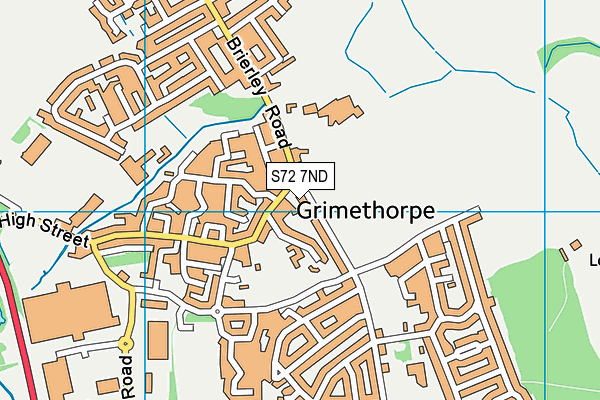
Where is Grimethorpe Miners Welfare Sports Ground (Closed)?
| Sub Building Name | |
| Building Name | |
| Building Number | 0 |
| Dependent Thoroughfare | |
| Thoroughfare Name | Cemetery Road |
| Double Dependent Locality | |
| Dependent Locality | Grimethorpe |
| PostTown | Barnsley |
| Postcode | S72 7ND |
Grimethorpe Miners Welfare Sports Ground (Closed) on a map

Grimethorpe Miners Welfare Sports Ground (Closed) geodata
| Easting | 441474.75 |
| Northing | 408995.7 |
| Latitude | 53.575928 |
| Longitude | -1.375112 |
| Local Authority Name | Barnsley |
| Local Authority Code | E08000016 |
| Parliamentary Constituency Name | Barnsley East |
| Parliamentary Constituency Code | E14000542 |
| Region Name | Yorkshire and the Humber |
| Region Code | E15000003 |
| Ward Name | North East |
| Ward Code | E05000987 |
| Output Area Code | E00037144 |
About this data
This data is open data sourced from Active Places Power and licenced under the Active Places Open Data Licence.
| Created On | 13th May 2008 |
| Audited On | 9th Dec 2014 |
| Checked On | 9th Dec 2014 |
