Goring Hall Recreation Ground - Goring-by-sea
Goring Hall Recreation Ground is located in Goring-by-sea, Worthing (BN12), and offers Grass Pitches.
| Address | Aldsworth Avenue, Goring-by-sea, Worthing, BN12 5AT |
| Management Type | Local Authority (in house) |
| Management Group | Local Authority |
| Owner Type | Local Authority |
| Owner Group | Local Authority |
| Education Phase | Not applicable |
Facilities
| Accessibility | Sports Club / Community Association |
| Management Type | Local Authority (in house) |
| Changing Rooms | No |
| Date Record Checked | 1st Jun 2023 |
| Opening Times | Dawn To Dusk |
Facility specifics
Disabled access
| Disabled Access | Yes |
| Activity Areas | Yes |
| Accessibility | Sports Club / Community Association |
| Management Type | Local Authority (in house) |
| Changing Rooms | No |
| Date Record Checked | 1st Jun 2023 |
| Opening Times | Dawn To Dusk |
Facility specifics
Disabled access
| Disabled Access | Yes |
| Activity Areas | Yes |
| Accessibility | Sports Club / Community Association |
| Management Type | Local Authority (in house) |
| Changing Rooms | No |
| Date Record Checked | 1st Jun 2023 |
| Opening Times | Dawn To Dusk |
Facility specifics
Disabled access
| Disabled Access | Yes |
| Activity Areas | Yes |
| Accessibility | Sports Club / Community Association |
| Management Type | Local Authority (in house) |
| Changing Rooms | No |
| Date Record Created | 21st May 2020 |
| Date Record Checked | 1st Jun 2023 |
| Opening Times | Dawn To Dusk |
Facility specifics
Disabled access
| Disabled Access | Yes |
| Activity Areas | Yes |
Contact
Disabled access
Disabled access for Goring Hall Recreation Ground
| Disabled Access | Yes |
| Activity Areas | Yes |
Where is Goring Hall Recreation Ground?
| Sub Building Name | |
| Building Name | |
| Building Number | 0 |
| Dependent Thoroughfare | |
| Thoroughfare Name | ALDSWORTH AVENUE |
| Double Dependent Locality | |
| Dependent Locality | GORING-BY-SEA |
| PostTown | WORTHING |
| Postcode | BN12 5AT |
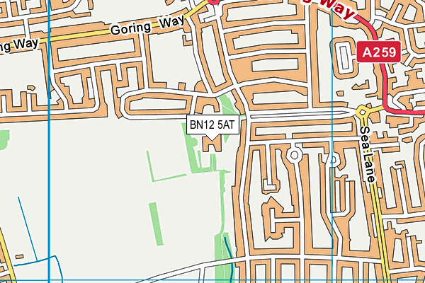
Goring Hall Recreation Ground on a map

Goring Hall Recreation Ground geodata
| Easting | 510547.3 |
| Northing | 102273.02 |
| Latitude | 50.809472 |
| Longitude | -0.432361 |
| Local Authority Name | Worthing |
| Local Authority Code | E07000229 |
| Parliamentary Constituency Name | Worthing West |
| Parliamentary Constituency Code | E14001055 |
| Region Name | South East |
| Region Code | E15000008 |
| Ward Name | Goring |
| Ward Code | E05007699 |
| Output Area Code | E00162192 |
About this data
This data is open data sourced from Active Places Power and licenced under the Active Places Open Data Licence.
| Created On | 23rd Oct 2009 |
| Audited On | 1st Jun 2023 |
| Checked On | 1st Jun 2023 |
