Fleetwood Bowling Club (Closed)
Fleetwood Bowling Club (Closed) is located in Fleetwood (FY7).
| Address | Upper Lune Street, Fleetwood, FY7 6BP |
| Management Type | Sport Club |
| Management Group | Others |
| Owner Type | Sports Club |
| Owner Group | Sports Club |
| Education Phase | Not Known |
| Closure Date | 30th Aug 2016 |
| Closure Reason | Unclassified |
Facilities
| Closure Date | 30th Aug 2016 |
| Closure Reason | Unclassified |
| Accessibility | Sports Club / Community Association |
| Management Type | Sport Club |
| Changing Rooms | No |
| Date Record Checked | 30th Aug 2016 |
Opening times
| Access description | Sports Club / Community Association |
|---|
| Opening time | 18:00 |
| Closing time | 23:59 |
| Period open for | Saturday |
| |
| Access description | Sports Club / Community Association |
|---|
| Opening time | 12:00 |
| Closing time | 23:59 |
| Period open for | Sunday |
| |
| Access description | Sports Club / Community Association |
|---|
| Opening time | 18:00 |
| Closing time | 23:59 |
| Period open for | Monday-Friday |
Facility specifics
| Area | 40m² |
| Floor Matting | Don't Know |
| Gymnastics Trampoline Use | Don't Know |
| Length | 8m |
| Moveable Balance Apparatus | Don't Know |
| Moveable Large Apparatus | Don't Know |
| Moveable Rebound Apparatus | Don't Know |
| Moveable Trampolines | Don't Know |
| Width | 5m |
| Small Apparatus | Don't Know |
| Swinging and Hanging Apparatus | Don't Know |
Disabled access
| Disabled Access | Yes |
| Finding/Reaching Entrance | Yes |
| Reception Area | Yes |
| Doorways | Yes |
| Activity Areas | Yes |
| Disabled Toilets | Yes |
| Social Areas | Yes |
| Emergency Exits | Yes |
Contact
Disabled access
Disabled access for Fleetwood Bowling Club (Closed)
| Disabled Access | Yes |
| Finding/Reaching Entrance | Yes |
| Reception Area | Yes |
| Doorways | Yes |
| Activity Areas | Yes |
| Disabled Toilets | Yes |
| Social Areas | Yes |
| Emergency Exits | Yes |
Where is Fleetwood Bowling Club (Closed)?
| Sub Building Name | |
| Building Name | |
| Building Number | 0 |
| Dependent Thoroughfare | |
| Thoroughfare Name | Upper Lune Street |
| Double Dependent Locality | |
| Dependent Locality | |
| PostTown | Fleetwood |
| Postcode | FY7 6BP |
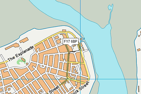
Fleetwood Bowling Club (Closed) on a map

Fleetwood Bowling Club (Closed) geodata
| Easting | 333933.54 |
| Northing | 448356.23 |
| Latitude | 53.927103 |
| Longitude | -3.007602 |
| Local Authority Name | Wyre |
| Local Authority Code | E07000128 |
| Parliamentary Constituency Name | Lancaster and Fleetwood |
| Parliamentary Constituency Code | E14000776 |
| Region Name | North West |
| Region Code | E15000002 |
| Ward Name | Pharos |
| Ward Code | E05009946 |
| Output Area Code | E00129837 |
About this data
This data is open data sourced from Active Places Power and licenced under the Active Places Open Data Licence.
| Created On | 10th Feb 2014 |
| Audited On | 27th Jun 2011 |
| Checked On | 27th Jun 2011 |
