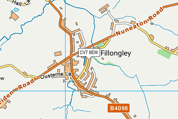
Fillongley Recreation Ground
Fillongley Recreation Ground is located in Fillongley (CV7), and offers Grass Pitches.
| Address | FILLONGLEY RECREATION GROUND, Church Lane, Fillongley, CV7 8EW |
| Car Park | Yes |
| Car Park Capacity | 32 |
| Management Type | Local Authority (in house) |
| Management Group | Local Authority |
| Owner Type | Local Authority |
| Owner Group | Local Authority |
| Education Phase | Not applicable |
Facilities
| Accessibility | Sports Club / Community Association |
| Management Type | Local Authority (in house) |
| Changing Rooms | Yes |
| Date Record Created | 23rd Oct 2018 |
| Date Record Checked | 13th Apr 2023 |
| Opening Times | Dawn To Dusk |
Facility specifics
Disabled access
| Notes | No specific disabled access; it is a field with no paths. 2 car parks - one hard standing/grasscrete and one tarmacked. Around 16 spaces in each |
| Accessibility | Sports Club / Community Association |
| Management Type | Community Organisation |
| Changing Rooms | Yes |
| Date Record Created | 23rd Oct 2019 |
| Date Record Checked | 13th Apr 2023 |
| Opening Times | Dawn To Dusk |
Facility specifics
Disabled access
| Notes | No specific disabled access; it is a field with no paths. 2 car parks - one hard standing/grasscrete and one tarmacked. Around 16 spaces in each |
| Accessibility | Sports Club / Community Association |
| Management Type | Local Authority (in house) |
| Changing Rooms | Yes |
| Date Record Created | 8th Feb 2022 |
| Date Record Checked | 13th Apr 2023 |
| Opening Times | Dawn To Dusk |
Facility specifics
Disabled access
| Notes | No specific disabled access; it is a field with no paths. 2 car parks - one hard standing/grasscrete and one tarmacked. Around 16 spaces in each |
Contact
Disabled access
Disabled access for Fillongley Recreation Ground
| Notes | No specific disabled access; it is a field with no paths. 2 car parks - one hard standing/grasscrete and one tarmacked. Around 16 spaces in each |
Where is Fillongley Recreation Ground?
| Sub Building Name | |
| Building Name | FILLONGLEY RECREATION GROUND |
| Building Number | 0 |
| Dependent Thoroughfare | |
| Thoroughfare Name | CHURCH LANE |
| Double Dependent Locality | |
| Dependent Locality | |
| PostTown | FILLONGLEY |
| Postcode | CV7 8EW |
Fillongley Recreation Ground on a map

Fillongley Recreation Ground geodata
| Easting | 428385 |
| Northing | 287309 |
| Latitude | 52.48297 |
| Longitude | -1.583456 |
| Local Authority Name | North Warwickshire |
| Local Authority Code | E07000218 |
| Parliamentary Constituency Name | North Warwickshire |
| Parliamentary Constituency Code | E14000854 |
| Region Name | West Midlands |
| Region Code | E15000005 |
| Ward Name | Fillongley |
| Ward Code | E05007466 |
| Output Area Code | E00158171 |
About this data
This data is open data sourced from Active Places Power and licenced under the Active Places Open Data Licence.
| toid | osgb1000002074906019 |
| Created On | 23rd Oct 2018 |
| Audited On | 13th Apr 2023 |
| Checked On | 13th Apr 2023 |
