Farmer Johns Mtb Park - Marple Bridge
Farmer Johns Mtb Park is located in Marple Bridge, Stockport (SK6), and offers Cycling.
| Address | HILLSIDE FARM, 57, Cote Green Road, Marple Bridge, Stockport, SK6 5EN |
| Car Park | Yes |
| Car Park Capacity | 50 |
| Management Type | Sport Club |
| Management Group | Others |
| Owner Type | Sports Club |
| Owner Group | Sports Club |
| Education Phase | Not applicable |
Facilities
| Status Notes | Several different trails. |
| Accessibility | Pay and Play |
| Management Type | Sport Club |
| Year Built | 1999 |
| Changing Rooms | Yes |
| Date Record Created | 27th Feb 2017 |
| Date Record Checked | 20th Sep 2023 |
| Opening Times | Dawn To Dusk |
Facility specifics
| Bike Wash | No |
| Black Trails | Yes |
| Blue Trails | No |
| Extreme Trails | No |
| Green Trails | No |
| Length of Black Trails | 0.576m |
| Length of Red Trails | 0.265m |
| Overall Width | 3m |
| Red Trails | Yes |
| Surface | Various |
| Total Length | 841m |
Contact
Where is Farmer Johns Mtb Park?
| Sub Building Name | |
| Building Name | HILLSIDE FARM |
| Building Number | 57 |
| Dependent Thoroughfare | |
| Thoroughfare Name | COTE GREEN ROAD |
| Double Dependent Locality | |
| Dependent Locality | MARPLE BRIDGE |
| PostTown | STOCKPORT |
| Postcode | SK6 5EN |
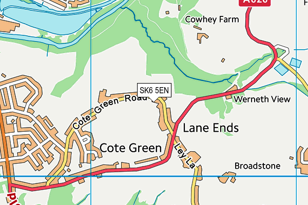
Farmer Johns Mtb Park on a map

Farmer Johns Mtb Park geodata
| Easting | 397039 |
| Northing | 390372 |
| Latitude | 53.410152 |
| Longitude | -2.046009 |
| Local Authority Name | Stockport |
| Local Authority Code | E08000007 |
| Parliamentary Constituency Name | Hazel Grove |
| Parliamentary Constituency Code | E14000738 |
| Region Name | North West |
| Region Code | E15000002 |
| Ward Name | Marple North |
| Ward Code | E05000794 |
| Output Area Code | E00029784 |
About this data
This data is open data sourced from Active Places Power and licenced under the Active Places Open Data Licence.
| toid | osgb1000025026752 |
| Created On | 27th Feb 2017 |
| Audited On | 20th Sep 2023 |
| Checked On | 20th Sep 2023 |
