East Dorset Indoor Bowls Club - Christchurch
East Dorset Indoor Bowls Club is located in Christchurch (BH23), and offers Indoor Bowls.
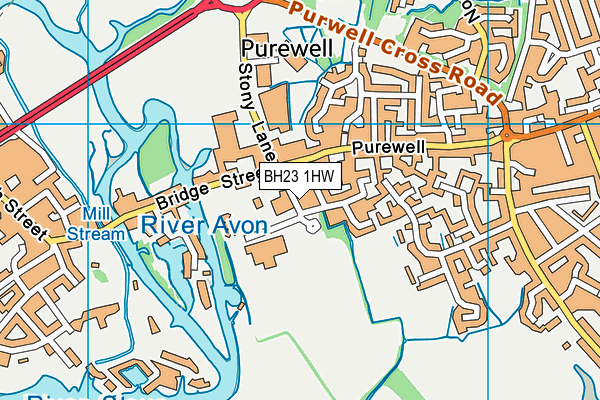
| Address | Stony Lane South, Christchurch, BH23 1HW |
| Management Type | Sport Club |
| Management Group | Others |
| Owner Type | Sports Club |
| Owner Group | Sports Club |
| Education Phase | Not applicable |
Facilities
| Status Notes | Opening times October - April.
Summer months open on selected days. |
| Accessibility | Sports Club / Community Association |
| Management Type | Sport Club |
| Year Built | 1977 |
| Year Refurbished | 2000 |
| Changing Rooms | Yes |
| Year Changing Rooms Refurbished | 2009 |
| Date Record Checked | 25th Jul 2023 |
Opening times
| Access description | Sports Club / Community Association |
|---|
| Opening time | 09:00 |
| Closing time | 22:00 |
| Period open for | Every day |
Facility specifics
| Area | 988m² |
| Length | 36.6m |
| Width | 27m |
Disabled access
| Disabled Access | Yes |
| Finding/Reaching Entrance | Yes |
| Reception Area | Yes |
| Doorways | Yes |
| Disabled Changing Facilities | Yes |
| Activity Areas | Yes |
| Disabled Toilets | Yes |
| Social Areas | Yes |
| Spectator Areas | Yes |
| Emergency Exits | Yes |
| Notes | Finding/Reaching Entrance: Sloped, Activity Areas: Ramp to bowling rink |
Contact
Disabled access
Disabled access for East Dorset Indoor Bowls Club
| Disabled Access | Yes |
| Finding/Reaching Entrance | Yes |
| Reception Area | Yes |
| Doorways | Yes |
| Disabled Changing Facilities | Yes |
| Activity Areas | Yes |
| Disabled Toilets | Yes |
| Social Areas | Yes |
| Spectator Areas | Yes |
| Emergency Exits | Yes |
| Notes | Finding/Reaching Entrance: Sloped, Activity Areas: Ramp to bowling rink |
Where is East Dorset Indoor Bowls Club?
| Sub Building Name | |
| Building Name | |
| Building Number | 0 |
| Dependent Thoroughfare | |
| Thoroughfare Name | STONY LANE SOUTH |
| Double Dependent Locality | |
| Dependent Locality | |
| PostTown | CHRISTCHURCH |
| Postcode | BH23 1HW |
East Dorset Indoor Bowls Club on a map

East Dorset Indoor Bowls Club geodata
| Easting | 416476.14 |
| Northing | 92698.59 |
| Latitude | 50.733672 |
| Longitude | -1.767901 |
| Local Authority Name | Bournemouth, Christchurch and Poole |
| Local Authority Code | E06000058 |
| Parliamentary Constituency Name | Christchurch |
| Parliamentary Constituency Code | E14000638 |
| Region Name | South West |
| Region Code | E15000009 |
| Ward Name | Christchurch Town |
| Ward Code | E05012658 |
| Output Area Code | E00103177 |
About this data
This data is open data sourced from Active Places Power and licenced under the Active Places Open Data Licence.
| toid | osgb1000012906790 |
| Created On | 18th May 2004 |
| Audited On | 25th Jul 2023 |
| Checked On | 25th Jul 2023 |
