Doncaster Road Playing Fields - Bristol
Doncaster Road Playing Fields is located in Bristol (BS10).
| Address | Doncaster Road, Bristol, BS10 5PX |
| Management Type | Local Authority (in house) |
| Management Group | Local Authority |
| Owner Type | Local Authority |
| Owner Group | Local Authority |
| Education Phase | Not applicable |
Facilities
| Closure Date | 1st May 2018 |
| Closure Reason | Strategic Review - facility/site not being replaced |
| Accessibility | Free Public Access |
| Management Type | Local Authority (in house) |
| Year Built | 1981 |
| Changing Rooms | No |
| Date Record Created | 27th Feb 2017 |
| Date Record Checked | 6th Sep 2022 |
| Opening Times | Dawn To Dusk |
Facility specifics
| Degree Of Banking At Middle Of Bends | 1° |
| Degree Of Banking At Middle Of Straights | 1° |
| Floodlit | No |
| Overall Width | 6m |
| Surface | Shale |
| Total Length | 87m |
Disabled access
| Disabled Access | Yes |
| Finding/Reaching Entrance | Yes |
| Accessibility | Free Public Access |
| Management Type | Local Authority (in house) |
| Changing Rooms | No |
| Date Record Created | 27th Feb 2017 |
| Date Record Checked | 12th Sep 2022 |
| Opening Times | Dawn To Dusk |
Facility specifics
Disabled access
| Disabled Access | Yes |
| Finding/Reaching Entrance | Yes |
| Notes | Disability access into the public park but no facilities exist at this site. No buildings exist here. |
Contact
Disabled access
Disabled access for Doncaster Road Playing Fields
| Disabled Access | Yes |
| Finding/Reaching Entrance | Yes |
| Notes | Disability access into the public park but no facilities exist at this site. No buildings exist here. |
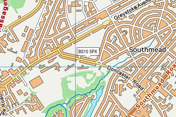
Where is Doncaster Road Playing Fields?
| Sub Building Name | |
| Building Name | |
| Building Number | 0 |
| Dependent Thoroughfare | |
| Thoroughfare Name | DONCASTER ROAD |
| Double Dependent Locality | |
| Dependent Locality | |
| PostTown | BRISTOL |
| Postcode | BS10 5PX |
Doncaster Road Playing Fields on a map

Doncaster Road Playing Fields geodata
| Easting | 358116.09 |
| Northing | 178160.05 |
| Latitude | 51.500816 |
| Longitude | -2.604791 |
| Local Authority Name | Bristol, City of |
| Local Authority Code | E06000023 |
| Parliamentary Constituency Name | Bristol North West |
| Parliamentary Constituency Code | E14000600 |
| Region Name | South West |
| Region Code | E15000009 |
| Ward Name | Southmead |
| Ward Code | E05010913 |
| Output Area Code | E00074217 |
About this data
This data is open data sourced from Active Places Power and licenced under the Active Places Open Data Licence.
| toid | osgb1000014976451 |
| Created On | 27th Feb 2017 |
| Audited On | 6th Sep 2022 |
| Checked On | 12th Sep 2022 |
