Cutbush Lane Recreation Ground - Southampton
Cutbush Lane Recreation Ground is located in Southampton (SO18), and offers Grass Pitches.
| Address | PLAYING FIELDS, Cutbush Lane, Southampton, SO18 3HY |
| Car Park | Yes |
| Car Park Capacity | 30 |
| Management Type | Local Authority (in house) |
| Management Group | Local Authority |
| Owner Type | Local Authority |
| Owner Group | Local Authority |
| Education Phase | Not applicable |
Facilities
| Accessibility | Sports Club / Community Association |
| Management Type | Local Authority (in house) |
| Year Built | 1991 |
| Changing Rooms | Yes |
| Date Record Checked | 3rd May 2023 |
Opening times
| Access description | Sports Club / Community Association |
|---|
| Opening time | 09:00 |
| Closing time | 17:00 |
| Period open for | Weekend |
Facility specifics
Disabled access
| Disabled Access | Yes |
| Disabled Parking | Yes |
| Disabled Changing Facilities | Yes |
| Disabled Toilets | Yes |
Contact
Disabled access
Disabled access for Cutbush Lane Recreation Ground
| Disabled Access | Yes |
| Disabled Parking | Yes |
| Disabled Changing Facilities | Yes |
| Disabled Toilets | Yes |
Where is Cutbush Lane Recreation Ground?
| Sub Building Name | |
| Building Name | PLAYING FIELDS |
| Building Number | 0 |
| Dependent Thoroughfare | |
| Thoroughfare Name | CUTBUSH LANE |
| Double Dependent Locality | |
| Dependent Locality | |
| PostTown | SOUTHAMPTON |
| Postcode | SO18 3HY |
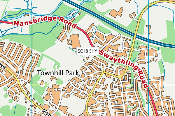
Cutbush Lane Recreation Ground on a map

Cutbush Lane Recreation Ground geodata
| Easting | 445390 |
| Northing | 115141 |
| Latitude | 50.933938 |
| Longitude | -1.355443 |
| Local Authority Name | Southampton |
| Local Authority Code | E06000045 |
| Parliamentary Constituency Name | Southampton, Itchen |
| Parliamentary Constituency Code | E14000955 |
| Region Name | South East |
| Region Code | E15000008 |
| Ward Name | Bitterne Park |
| Ward Code | E05002459 |
| Output Area Code | E00086733 |
About this data
This data is open data sourced from Active Places Power and licenced under the Active Places Open Data Licence.
| toid | osgb1000002109355978 |
| Created On | 28th Sep 2005 |
| Audited On | 3rd May 2023 |
| Checked On | 3rd May 2023 |
