Cressex Football Centre - High Wycombe
Cressex Football Centre is located in High Wycombe (HP12), and offers Artificial Grass Pitch.
| Address | Holmer Lane, High Wycombe, HP12 4QA |
| Car Park | Yes |
| Car Park Capacity | 50 |
| Management Type | Local Authority (in house) |
| Management Group | Local Authority |
| Owner Type | Local Authority |
| Owner Group | Local Authority |
| Education Phase | Not applicable |
Aliases
Cressex Football Centre is also known as:
- Cressex Synthetic Sports Pitch Centre
Facilities
| Accessibility | Sports Club / Community Association |
| Management Type | Local Authority (in house) |
| Year Built | 1986 |
| Year Refurbished | 2018 |
| Changing Rooms | Yes |
| Year Changing Rooms Refurbished | 2006 |
| Date Record Checked | 31st Mar 2023 |
Opening times
| Access description | Private Use |
|---|
| Opening time | 09:00 |
| Closing time | 17:00 |
| Period open for | Monday-Friday |
| |
| Access description | Sports Club / Community Association |
|---|
| Opening time | 17:00 |
| Closing time | 22:00 |
| Period open for | Monday-Friday |
| |
| Access description | Sports Club / Community Association |
|---|
| Opening time | 09:00 |
| Closing time | 22:00 |
| Period open for | Weekend |
Facility specifics
| Area | 7000m² |
| Fill | Yes - Rubber |
| Floodlit | Yes |
| Indoor | No |
| Length | 100m |
| Pile Length | 30mm |
| Width | 70m |
| WR22 Compliant Pitch | No |
Disabled access
| Disabled Access | Yes |
| Disabled Parking | Yes |
| Finding/Reaching Entrance | Yes |
| Reception Area | Yes |
| Doorways | Yes |
| Disabled Changing Facilities | Yes |
| Activity Areas | Yes |
| Disabled Toilets | Yes |
| Emergency Exits | Yes |
Contact
Disabled access
Disabled access for Cressex Football Centre
| Disabled Access | Yes |
| Disabled Parking | Yes |
| Finding/Reaching Entrance | Yes |
| Reception Area | Yes |
| Doorways | Yes |
| Disabled Changing Facilities | Yes |
| Activity Areas | Yes |
| Disabled Toilets | Yes |
| Emergency Exits | Yes |
Where is Cressex Football Centre?
| Sub Building Name | |
| Building Name | |
| Building Number | 0 |
| Dependent Thoroughfare | |
| Thoroughfare Name | HOLMER LANE |
| Double Dependent Locality | |
| Dependent Locality | |
| PostTown | HIGH WYCOMBE |
| Postcode | HP12 4QA |
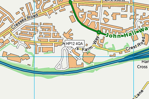
Cressex Football Centre on a map

Cressex Football Centre geodata
| Easting | 484522.19 |
| Northing | 191123.1 |
| Latitude | 51.612603 |
| Longitude | -0.780725 |
| Local Authority Name | Buckinghamshire |
| Local Authority Code | E06000060 |
| Parliamentary Constituency Name | Wycombe |
| Parliamentary Constituency Code | E14001056 |
| Region Name | South East |
| Region Code | E15000008 |
| Ward Name | Booker, Cressex and Castlefield |
| Ward Code | E05013131 |
| Output Area Code | E00090040 |
About this data
This data is open data sourced from Active Places Power and licenced under the Active Places Open Data Licence.
| Created On | 9th Feb 2012 |
| Audited On | 31st Mar 2023 |
| Checked On | 31st Mar 2023 |
