Common Road Playing Field - Thurnscoe
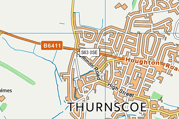
Common Road Playing Field is located in Thurnscoe, Barnsley (S63).
| Address | PLAYING FIELD, Common Road, Thurnscoe, Barnsley, S63 0SE |
| Management Type | Local Authority (in house) |
| Management Group | Local Authority |
| Owner Type | Local Authority |
| Owner Group | Local Authority |
| Education Phase | Not applicable |
Facilities
| Accessibility | Sports Club / Community Association |
| Management Type | Local Authority (in house) |
| Changing Rooms | No |
| Date Record Checked | 4th Jul 2023 |
| Opening Times | Dawn To Dusk |
Facility specifics
Contact
Where is Common Road Playing Field?
| Sub Building Name | |
| Building Name | PLAYING FIELD |
| Building Number | 0 |
| Dependent Thoroughfare | |
| Thoroughfare Name | COMMON ROAD |
| Double Dependent Locality | |
| Dependent Locality | THURNSCOE |
| PostTown | BARNSLEY |
| Postcode | S63 0SE |
Common Road Playing Field on a map

Common Road Playing Field geodata
| Easting | 444821.52 |
| Northing | 405732.34 |
| Latitude | 53.546323 |
| Longitude | -1.325039 |
| Local Authority Name | Barnsley |
| Local Authority Code | E08000016 |
| Parliamentary Constituency Name | Wentworth and Dearne |
| Parliamentary Constituency Code | E14001028 |
| Region Name | Yorkshire and the Humber |
| Region Code | E15000003 |
| Ward Name | Dearne North |
| Ward Code | E05000981 |
| Output Area Code | E00037389 |
About this data
This data is open data sourced from Active Places Power and licenced under the Active Places Open Data Licence.
| toid | osgb1000000085778616 |
| Created On | 7th Sep 2004 |
| Audited On | 4th Jul 2023 |
| Checked On | 4th Jul 2023 |
