Chatham Golf Range (Closed)
Chatham Golf Range (Closed) is located in Chatham (ME5).
| Address | Street End Road, Chatham, ME5 0BG |
| Car Park | Yes |
| Car Park Capacity | 50 |
| Management Type | Commercial Management |
| Management Group | Commercial |
| Owner Type | Commercial |
| Owner Group | Commercial |
| Education Phase | Not Known |
| Closure Date | 31st Mar 2018 |
| Closure Reason | Redevelopment - loss due to development project (e.g. major schemes such as HS2, new roads, area regeneration or smaller local development) |
Aliases
Chatham Golf Range (Closed) is also known as:
Facilities
| Closure Date | 31st Mar 2018 |
| Closure Reason | Redevelopment - loss due to development project (e.g. major schemes such as HS2, new roads, area regeneration or smaller local development) |
| Accessibility | Pay and Play |
| Management Type | Commercial Management |
| Year Built | 1971 |
| Year Refurbished | 2016 |
| Changing Rooms | No |
| Date Record Checked | 23rd Nov 2018 |
Opening times
| Access description | Pay and Play |
|---|
| Opening time | 09:00 |
| Closing time | 19:00 |
| Period open for | Weekend |
| |
| Access description | Pay and Play |
|---|
| Opening time | 10:00 |
| Closing time | 21:00 |
| Period open for | Monday-Friday |
Facility specifics
Disabled access
| Disabled Access | Yes |
| Finding/Reaching Entrance | Yes |
| Reception Area | Yes |
| Doorways | Yes |
| Activity Areas | Yes |
| Disabled Toilets | Yes |
| Emergency Exits | Yes |
Contact
Disabled access
Disabled access for Chatham Golf Range (Closed)
| Disabled Access | Yes |
| Finding/Reaching Entrance | Yes |
| Reception Area | Yes |
| Doorways | Yes |
| Activity Areas | Yes |
| Disabled Toilets | Yes |
| Emergency Exits | Yes |
Where is Chatham Golf Range (Closed)?
| Sub Building Name | |
| Building Name | |
| Building Number | 0 |
| Dependent Thoroughfare | |
| Thoroughfare Name | Street End Road |
| Double Dependent Locality | |
| Dependent Locality | |
| PostTown | Chatham |
| Postcode | ME5 0BG |
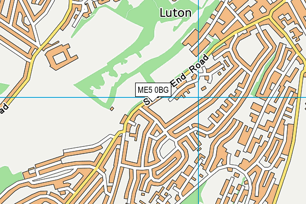
Chatham Golf Range (Closed) on a map

Chatham Golf Range (Closed) geodata
| Easting | 576600.7 |
| Northing | 165933.28 |
| Latitude | 51.365007 |
| Longitude | 0.535445 |
| Local Authority Name | Medway |
| Local Authority Code | E06000035 |
| Parliamentary Constituency Name | Chatham and Aylesford |
| Parliamentary Constituency Code | E14000626 |
| Region Name | South East |
| Region Code | E15000008 |
| Ward Name | Luton and Wayfield |
| Ward Code | E05002255 |
| Output Area Code | E00081207 |
About this data
This data is open data sourced from Active Places Power and licenced under the Active Places Open Data Licence.
| Created On | 26th Apr 2004 |
| Audited On | 6th Jul 2017 |
| Checked On | 23rd Nov 2018 |
