Brentwood School (Closed) - Timperley
Brentwood School (Closed) is located in Timperley, Altrincham (WA14).
| Address | Brentwood School, Brentwood Avenue, Timperley, Altrincham, WA14 1SR |
| Management Type | School/College/University (in house) |
| Management Group | Education |
| Owner Type | Community Special School |
| Owner Group | Education |
| Education Phase | Not applicable |
| Closure Date | 24th Mar 2017 |
| Closure Reason | Strategic Review - facility/site to be replaced at existing site |
Facilities
| Closure Date | 24th Mar 2017 |
| Closure Reason | Strategic Review - facility/site to be replaced at another site |
| Accessibility | Private Use |
| Management Type | School/College/University (in house) |
| Year Built | 1999 |
| Changing Rooms | Yes |
| Date Record Checked | 24th Mar 2017 |
| Opening Times | Detailed Timings |
Facility specifics
| Area | 180m² |
| Floor Matting | Don't Know |
| Gymnastics Trampoline Use | Don't Know |
| Length | 18m |
| Moveable Balance Apparatus | Don't Know |
| Moveable Large Apparatus | Don't Know |
| Moveable Rebound Apparatus | Don't Know |
| Moveable Trampolines | Don't Know |
| Width | 10m |
| Small Apparatus | Don't Know |
| Swinging and Hanging Apparatus | Don't Know |
Disabled access
| Disabled Access | Yes |
| Emergency Exits | Yes |
Contact
Disabled access
Disabled access for Brentwood School (Closed)
| Disabled Access | Yes |
| Emergency Exits | Yes |
Where is Brentwood School (Closed)?
| Sub Building Name | |
| Building Name | Brentwood School |
| Building Number | 0 |
| Dependent Thoroughfare | |
| Thoroughfare Name | Brentwood Avenue |
| Double Dependent Locality | |
| Dependent Locality | Timperley |
| PostTown | Altrincham |
| Postcode | WA14 1SR |
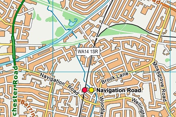
Brentwood School (Closed) on a map

Brentwood School (Closed) geodata
| Easting | 377260 |
| Northing | 389132 |
| Latitude | 53.39852 |
| Longitude | -2.343458 |
| Local Authority Name | Trafford |
| Local Authority Code | E08000009 |
| Parliamentary Constituency Name | Altrincham and Sale West |
| Parliamentary Constituency Code | E14000532 |
| Region Name | North West |
| Region Code | E15000002 |
| Ward Name | Broadheath |
| Ward Code | E05000822 |
| Output Area Code | E00030860 |
About this data
This data is open data sourced from Active Places Power and licenced under the Active Places Open Data Licence.
| Created On | 22nd Jul 2004 |
| Audited On | 1st Sep 2009 |
| Checked On | 1st Sep 2009 |
