Body Language (Closed) - Darton
Body Language (Closed) is located in Darton, Barnsley (S75).
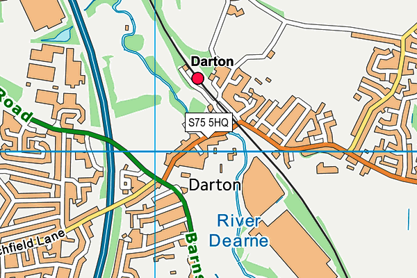
| Address | 70, Church Street, Darton, Barnsley, S75 5HQ |
| Car Park | Yes |
| Car Park Capacity | 20 |
| Management Type | Commercial Management |
| Management Group | Commercial |
| Owner Type | Commercial |
| Owner Group | Commercial |
| Education Phase | Not applicable |
| Closure Date | 28th Mar 2018 |
| Closure Reason | Strategic Review - facility/site not being replaced |
Facilities
| Closure Date | 28th Mar 2018 |
| Closure Reason | Strategic Review - facility/site not being replaced |
| Accessibility | Pay and Play |
| Management Type | Commercial Management |
| Year Built | 1994 |
| Changing Rooms | Yes |
| Date Record Checked | 28th Aug 2019 |
Opening times
| Access description | Pay and Play |
|---|
| Opening time | 09:00 |
| Closing time | 21:00 |
| Period open for | Monday |
| |
| Access description | Pay and Play |
|---|
| Opening time | 09:00 |
| Closing time | 21:00 |
| Period open for | Tuesday |
| |
| Access description | Pay and Play |
|---|
| Opening time | 09:00 |
| Closing time | 21:00 |
| Period open for | Wednesday |
| |
| Access description | Pay and Play |
|---|
| Opening time | 09:00 |
| Closing time | 21:00 |
| Period open for | Thursday |
| |
| Access description | Pay and Play |
|---|
| Opening time | 09:00 |
| Closing time | 19:00 |
| Period open for | Friday |
| |
| Access description | Pay and Play |
|---|
| Opening time | 09:00 |
| Closing time | 15:00 |
| Period open for | Saturday |
| |
| Access description | Pay and Play |
|---|
| Opening time | 09:00 |
| Closing time | 12:00 |
| Period open for | Sunday |
Facility specifics
Disabled access
| Disabled Access | Yes |
| Finding/Reaching Entrance | Yes |
| Reception Area | Yes |
| Doorways | Yes |
| Activity Areas | Yes |
| Disabled Toilets | Yes |
| Emergency Exits | Yes |
Contact
Disabled access
Disabled access for Body Language (Closed)
| Disabled Access | Yes |
| Finding/Reaching Entrance | Yes |
| Reception Area | Yes |
| Doorways | Yes |
| Activity Areas | Yes |
| Disabled Toilets | Yes |
| Emergency Exits | Yes |
Where is Body Language (Closed)?
| Sub Building Name | |
| Building Name | |
| Building Number | 70 |
| Dependent Thoroughfare | |
| Thoroughfare Name | CHURCH STREET |
| Double Dependent Locality | |
| Dependent Locality | DARTON |
| PostTown | BARNSLEY |
| Postcode | S75 5HQ |
Body Language (Closed) on a map

Body Language (Closed) geodata
| Easting | 431211 |
| Northing | 410046 |
| Latitude | 53.586077 |
| Longitude | -1.530006 |
| Local Authority Name | Barnsley |
| Local Authority Code | E08000016 |
| Parliamentary Constituency Name | Barnsley Central |
| Parliamentary Constituency Code | E14000541 |
| Region Name | Yorkshire and the Humber |
| Region Code | E15000003 |
| Ward Name | Darton West |
| Ward Code | E05000980 |
| Output Area Code | E00037304 |
About this data
This data is open data sourced from Active Places Power and licenced under the Active Places Open Data Licence.
| toid | osgb1000032684665 |
| Created On | 18th May 2004 |
| Audited On | 1st Aug 2018 |
| Checked On | 1st Aug 2018 |
