Bishops Stortford Golf Club - Bishop's Stortford
Bishops Stortford Golf Club is located in Bishop's Stortford (CM23), and offers Golf.
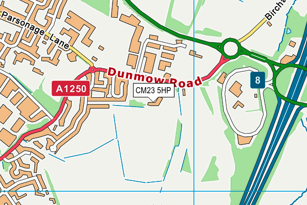
| Address | Dunmow Road, Bishop's Stortford, CM23 5HP |
| Car Park | Yes |
| Car Park Capacity | 100 |
| Management Type | Sport Club |
| Management Group | Others |
| Owner Type | Sports Club |
| Owner Group | Sports Club |
| Education Phase | Not applicable |
Facilities
| Accessibility | Registered Membership use |
| Management Type | Sport Club |
| Year Built | 2004 |
| Changing Rooms | Yes |
| Year Changing Rooms Refurbished | 2008 |
| Date Record Checked | 13th Sep 2023 |
| Opening Times | Dawn To Dusk |
Facility specifics
Disabled access
| Disabled Access | Yes |
| Disabled Parking | Yes |
| Finding/Reaching Entrance | Yes |
| Doorways | Yes |
| Activity Areas | Yes |
| Disabled Toilets | Yes |
| Social Areas | Yes |
| Spectator Areas | Yes |
| Emergency Exits | Yes |
| Accessibility | Registered Membership use |
| Management Type | Sport Club |
| Year Built | 1911 |
| Year Refurbished | 2017 |
| Changing Rooms | Yes |
| Year Changing Rooms Refurbished | 2008 |
| Date Record Checked | 13th Sep 2023 |
| Opening Times | Dawn To Dusk |
Facility specifics
Disabled access
| Disabled Access | Yes |
| Disabled Parking | Yes |
| Finding/Reaching Entrance | Yes |
| Doorways | Yes |
| Activity Areas | Yes |
| Disabled Toilets | Yes |
| Social Areas | Yes |
| Spectator Areas | Yes |
| Emergency Exits | Yes |
Contact
Disabled access
Disabled access for Bishops Stortford Golf Club
| Disabled Access | Yes |
| Disabled Parking | Yes |
| Finding/Reaching Entrance | Yes |
| Doorways | Yes |
| Activity Areas | Yes |
| Disabled Toilets | Yes |
| Social Areas | Yes |
| Spectator Areas | Yes |
| Emergency Exits | Yes |
| Notes | Buggy hire. |
Where is Bishops Stortford Golf Club?
| Sub Building Name | |
| Building Name | |
| Building Number | 0 |
| Dependent Thoroughfare | |
| Thoroughfare Name | DUNMOW ROAD |
| Double Dependent Locality | |
| Dependent Locality | |
| PostTown | BISHOP'S STORTFORD |
| Postcode | CM23 5HP |
Bishops Stortford Golf Club on a map

Bishops Stortford Golf Club geodata
| Easting | 550805 |
| Northing | 221429 |
| Latitude | 51.871053 |
| Longitude | 0.189073 |
| Local Authority Name | East Hertfordshire |
| Local Authority Code | E07000242 |
| Parliamentary Constituency Name | Hertford and Stortford |
| Parliamentary Constituency Code | E14000744 |
| Region Name | Eastern |
| Region Code | E15000006 |
| Ward Name | Bishop's Stortford All Saints |
| Ward Code | E05012981 |
| Output Area Code | E00119061 |
About this data
This data is open data sourced from Active Places Power and licenced under the Active Places Open Data Licence.
| toid | osgb1000010209605 |
| Created On | 26th Apr 2004 |
| Audited On | 13th Sep 2023 |
| Checked On | 13th Sep 2023 |
