Betteshanger Park - Sholden
Betteshanger Park is located in Sholden, Deal (CT14), and offers Cycling.
| Address | VISITOR CENTRE, Sandwich Road, Sholden, Deal, CT14 0BF |
| Car Park | Yes |
| Car Park Capacity | 500 |
| Management Type | Local Authority (in house) |
| Management Group | Local Authority |
| Owner Type | Local Authority |
| Owner Group | Local Authority |
| Education Phase | Not applicable |
Aliases
Betteshanger Park is also known as:
Facilities
| Accessibility | Pay and Play |
| Management Type | Local Authority (in house) |
| Year Built | 2005 |
| Changing Rooms | No |
| Date Record Created | 27th Feb 2017 |
| Date Record Checked | 3rd Oct 2023 |
| Opening Times | Dawn To Dusk |
Facility specifics
| Bike Wash | No |
| Black Trails | No |
| Blue Trails | Yes |
| Extreme Trails | No |
| Green Trails | No |
| Length of Blue Trails | 7m |
| Length of Red Trails | 11m |
| Overall Width | 10m |
| Red Trails | Yes |
| Surface | Various |
| Total Length | 18000m |
Disabled access
| Disabled Access | Yes |
| Disabled Parking | Yes |
| Activity Areas | Yes |
| Disabled Toilets | Yes |
| Accessibility | Pay and Play |
| Management Type | Local Authority (in house) |
| Year Built | 2005 |
| Changing Rooms | Yes |
| Date Record Created | 20th Jul 2018 |
| Date Record Checked | 3rd Oct 2023 |
| Opening Times | Dawn To Dusk |
Facility specifics
| Finish Straight Length | 100m |
| Finish Straight Width | 5m |
| Floodlit | No |
| Overall Width | 5m |
| Surface | Macadam |
| Timing System | No |
| Total Length | 3000m |
Disabled access
| Disabled Access | Yes |
| Disabled Parking | Yes |
| Activity Areas | Yes |
| Disabled Toilets | Yes |
Contact
Disabled access
Disabled access for Betteshanger Park
| Disabled Access | Yes |
| Disabled Parking | Yes |
| Activity Areas | Yes |
| Disabled Toilets | Yes |
Where is Betteshanger Park?
| Sub Building Name | |
| Building Name | VISITOR CENTRE |
| Building Number | 0 |
| Dependent Thoroughfare | |
| Thoroughfare Name | SANDWICH ROAD |
| Double Dependent Locality | |
| Dependent Locality | SHOLDEN |
| PostTown | DEAL |
| Postcode | CT14 0BF |
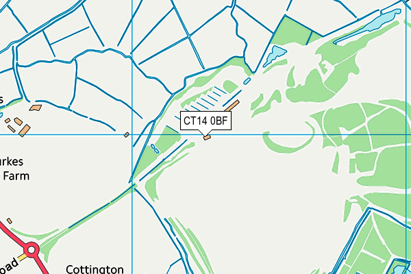
Betteshanger Park on a map

Betteshanger Park geodata
| Easting | 635271.47 |
| Northing | 153990.05 |
| Latitude | 51.236554 |
| Longitude | 1.369 |
| Local Authority Name | Dover |
| Local Authority Code | E07000108 |
| Parliamentary Constituency Name | Dover |
| Parliamentary Constituency Code | E14000670 |
| Region Name | South East |
| Region Code | E15000008 |
| Ward Name | Eastry Rural |
| Ward Code | E05012859 |
| Output Area Code | E00122935 |
About this data
This data is open data sourced from Active Places Power and licenced under the Active Places Open Data Licence.
| toid | osgb1000002032962840 |
| Created On | 27th Feb 2017 |
| Audited On | 3rd Oct 2023 |
| Checked On | 3rd Oct 2023 |
