Ascension Church Hall - Aldershot
Ascension Church Hall is located in Aldershot (GU11), and offers Sports Hall.
| Address | ASCENSION HOUSE, Ayling Hill, Aldershot, GU11 3LL |
| Car Park | Yes |
| Car Park Capacity | 6 |
| Management Type | Community Organisation |
| Management Group | Others |
| Owner Type | Community Organisation |
| Owner Group | Community Organisation |
| Education Phase | Not applicable |
Facilities
| Status Notes | Church hall. |
| Accessibility | Sports Club / Community Association |
| Management Type | Community Organisation |
| Year Built | 1968 |
| Changing Rooms | Yes |
| Date Record Checked | 17th Jan 2023 |
Opening times
| Access description | Sports Club / Community Association |
|---|
| Opening time | 09:00 |
| Closing time | 22:00 |
| Period open for | Every day |
Facility specifics
| Area | 170m² |
| Floor Matting | Don't Know |
| Gymnastics Trampoline Use | Don't Know |
| Length | 17m |
| Moveable Balance Apparatus | Don't Know |
| Moveable Large Apparatus | Don't Know |
| Moveable Rebound Apparatus | Don't Know |
| Moveable Trampolines | Don't Know |
| Width | 10m |
| Small Apparatus | Don't Know |
| Swinging and Hanging Apparatus | Don't Know |
Disabled access
| Disabled Access | Yes |
| Disabled Parking | Yes |
| Finding/Reaching Entrance | Yes |
| Reception Area | Yes |
| Doorways | Yes |
| Activity Areas | Yes |
| Social Areas | Yes |
| Spectator Areas | Yes |
| Emergency Exits | Yes |
Contact
Disabled access
Disabled access for Ascension Church Hall
| Disabled Access | Yes |
| Disabled Parking | Yes |
| Finding/Reaching Entrance | Yes |
| Reception Area | Yes |
| Doorways | Yes |
| Activity Areas | Yes |
| Social Areas | Yes |
| Spectator Areas | Yes |
| Emergency Exits | Yes |
Where is Ascension Church Hall?
| Sub Building Name | |
| Building Name | ASCENSION HOUSE |
| Building Number | 0 |
| Dependent Thoroughfare | |
| Thoroughfare Name | AYLING HILL |
| Double Dependent Locality | |
| Dependent Locality | |
| PostTown | ALDERSHOT |
| Postcode | GU11 3LL |
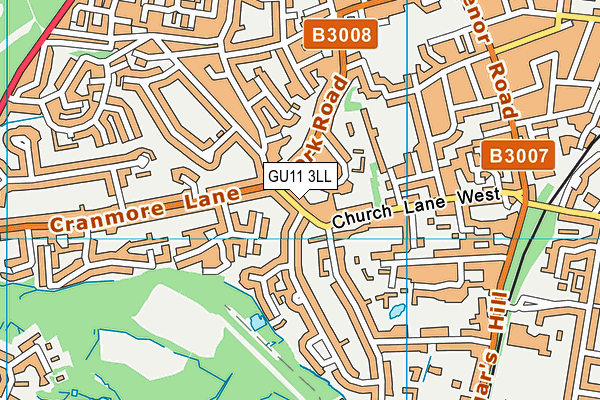
Ascension Church Hall on a map

Ascension Church Hall geodata
| Easting | 485778.2 |
| Northing | 150080.72 |
| Latitude | 51.243463 |
| Longitude | -0.772515 |
| Local Authority Name | Rushmoor |
| Local Authority Code | E07000092 |
| Parliamentary Constituency Name | Aldershot |
| Parliamentary Constituency Code | E14000530 |
| Region Name | South East |
| Region Code | E15000008 |
| Ward Name | Rowhill |
| Ward Code | E05008997 |
| Output Area Code | E00117527 |
About this data
This data is open data sourced from Active Places Power and licenced under the Active Places Open Data Licence.
| Created On | 7th Jan 2005 |
| Audited On | 17th Jan 2023 |
| Checked On | 17th Jan 2023 |
