Ainstable Leisure Swimming Pool (Closed)
Ainstable Leisure Swimming Pool (Closed) is located in Ainstable (CA4).
| Address | SWIMMING POOL, FAUGH HEAD, Ainstable To Armathwaite On The U3050, Ainstable, CA4 9QW |
| Car Park | Yes |
| Car Park Capacity | 10 |
| Management Type | Other |
| Management Group | Others |
| Owner Type | Other |
| Owner Group | Others |
| Education Phase | Select ... |
| Closure Date | 1st Jun 2018 |
| Closure Reason | Strategic Review - facility/site not being replaced |
Facilities
| Closure Date | 1st Jun 2018 |
| Closure Reason | Strategic Review - facility/site not being replaced |
| Accessibility | Pay and Play |
| Management Type | Other |
| Changing Rooms | Yes |
| Date Record Created | 8th Mar 2017 |
| Date Record Checked | 19th Mar 2019 |
Opening times
| Access description | Pay and Play |
|---|
| Opening time | 09:00 |
| Closing time | 20:00 |
| Period open for | Monday-Friday |
| |
| Access description | Pay and Play |
|---|
| Opening time | 09:00 |
| Closing time | 19:00 |
| Period open for | Sunday |
Facility specifics
| Access to Pool Hoist | No |
| Area | 72m² |
| Diving Boards | No |
| Length | 12m |
| Maximum Depth | 1.3m |
| Minimum Depth | 1.3m |
| Movable Floor | No |
| Width | 6m |
Disabled access
| Disabled Access | Yes |
| Finding/Reaching Entrance | Yes |
| Social Areas | Yes |
| Spectator Areas | Yes |
| Emergency Exits | Yes |
Contact
Disabled access
Disabled access for Ainstable Leisure Swimming Pool (Closed)
| Disabled Access | Yes |
| Finding/Reaching Entrance | Yes |
| Social Areas | Yes |
| Spectator Areas | Yes |
| Emergency Exits | Yes |
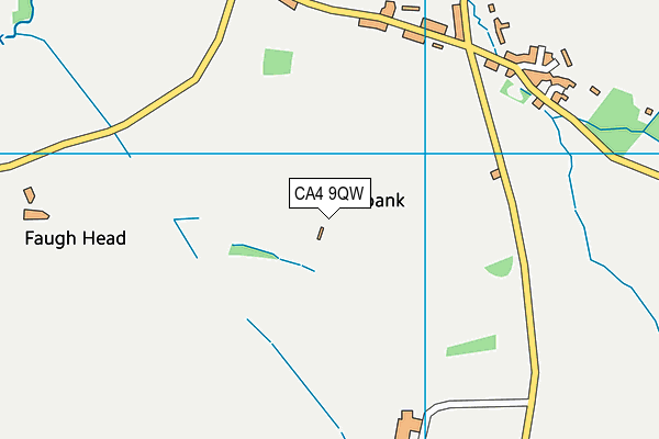
Where is Ainstable Leisure Swimming Pool (Closed)?
| Sub Building Name | SWIMMING POOL |
| Building Name | FAUGH HEAD |
| Building Number | 0 |
| Dependent Thoroughfare | |
| Thoroughfare Name | AINSTABLE TO ARMATHWAITE ON THE U3050 |
| Double Dependent Locality | |
| Dependent Locality | |
| PostTown | AINSTABLE |
| Postcode | CA4 9QW |
Ainstable Leisure Swimming Pool (Closed) on a map

Ainstable Leisure Swimming Pool (Closed) geodata
| Easting | 352091 |
| Northing | 545905 |
| Latitude | 54.805712 |
| Longitude | -2.746858 |
| Local Authority Name | Eden |
| Local Authority Code | E07000030 |
| Parliamentary Constituency Name | Penrith and The Border |
| Parliamentary Constituency Code | E14000877 |
| Region Name | North West |
| Region Code | E15000002 |
| Ward Name | Kirkoswald |
| Ward Code | E05003218 |
| Output Area Code | E00097641 |
About this data
This data is open data sourced from Active Places Power and licenced under the Active Places Open Data Licence.
| toid | osgb1000002583012600 |
| Created On | 8th Mar 2017 |
| Audited On | 6th Mar 2018 |
| Checked On | 6th Mar 2018 |
