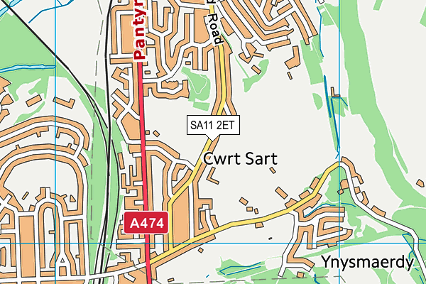
Ysgol Carreg Hir is located in Briton Ferry, Neath and falls under the local authority of Neath Port Talbot. The type of establishment is welsh establishment.
| Address | Ysgol Carreg Hir Old Road Briton Ferry Neath SA11 2ET |
GetTheData
Source: Get Information About Schools
Licence: Open Government Licence
| Phase of Education | Not applicable |
| Type of Establishment | Welsh establishment |
| Official Sixth Form | Not applicable |
| Religious Character | None |
| Diocese | Not applicable |
| Special Classes | Not applicable |
GetTheData
Source: Get Information About Schools
Licence: Open Government Licence
| Street Address | Old Road |
| Locality | Briton Ferry |
| Town | Neath |
| Postcode | SA11 2ET |
| ➜ More SA11 2ET open data | |
GetTheData
Source: Get Information About Schools
Licence: Open Government Licence

GetTheData
Source: OS VectorMap District (Ordnance Survey)
Licence: Open Government Licence (requires attribution)
| Ofsted Special Measures | Not applicable |
GetTheData
Source: Get Information About Schools
Licence: Open Government Licence
| Establishment Name | Ysgol Carreg Hir |
| Establishment Number | 2241 |
| Unique Reference Number | 402414 |
| Local Authority | Neath Port Talbot |
| Local Authority Code | 671 |
| Previous Local Authority Code | 999 |
| Government Statistical Service Local Authority Code | W06000012 |
| Government Office Region | Wales (pseudo) |
| District | Neath Port Talbot |
| District Code | W06000012 |
| Ward | Briton Ferry East |
| Parliamentary Constituency | Aberavon |
| Urban/Rural Description | (England/Wales) Urban city and town |
| Middle Super Output Area | Neath Port Talbot 013 |
| Lower Super Output Area | Neath Port Talbot 013A |
GetTheData
Source: Get Information About Schools
Licence: Open Government Licence
| Establishment Status | Open |
| Last Changed Date | 1st February 2023 |
| Reason Establishment Opened | Result of Amalgamation |
| Open Date | 1st September 2018 |
GetTheData
Source: Get Information About Schools
Licence: Open Government Licence
| Teenage Mothers | Not applicable |
| Special Educational Needs (SEN) Provision in Primary Care Unit | Not applicable |
| Pupil Referral Unit (PRU) Provides for Educational and Behavioural Difficulties (EBD) | Not applicable |
GetTheData
Source: Get Information About Schools
Licence: Open Government Licence
| Section 41 Approved | Not approved |
GetTheData
Source: Get Information About Schools
Licence: Open Government Licence
| Trust flag | Not applicable |
| School Sponsor flag | Not applicable |
GetTheData
Source: Get Information About Schools
Licence: Open Government Licence
| Federation flag | Not applicable |
GetTheData
Source: Get Information About Schools
Licence: Open Government Licence
GetTheData
Source: Get Information About Schools
Licence: Open Government Licence
| Easting | 274398 |
| Northing | 195465 |
| Latitude | 51.64391 |
| Longitude | -3.81663 |
GetTheData
Source: Get Information About Schools
Licence: Open Government Licence
| School | Phase of Education | Distance |
|---|---|---|
| YGG Tyle'r Ynn Llansawel Crescent, Briton Ferry, Castell Nedd, SA11 2UN | Not applicable | 318m |
| Horizons Educare 122 Old Road, Neath, SA11 2DE | Not applicable | 696m |
| St Joseph's Catholic Primary School (Neath) Cook Rees Avenue, Neath, SA11 1UR | Not applicable | 1.7km |
| Gnoll Primary School Wellfield Avenue, Neath, SA11 1AQ | Not applicable | 1.9km |
| Alderman Davies CIW Primary School St David's Street, Neath, SA11 3AA | Not applicable | 2.3km |
| Ysgol Gynradd Gymraeg Tregeles St. Johns Terrace, Neath Abbey, Neath, SA10 7ND | Not applicable | 2.3km |
| YGG Castell-nedd Heol Woodland, Castell-Nedd, SA11 3AL | Not applicable | 2.3km |
| Dwr Y Felin Comprehensive School Dwr Y Felin Road, Neath, SA10 7RE | Not applicable | 2.5km |
| Coedffranc Primary School Stanley Road, Skewen, Neath, SA10 6LP | Not applicable | 2.6km |
| Baglan Primary School Elmwood Road, Baglan, Port Talbot, SA12 8TF | Not applicable | 2.8km |
GetTheData
Source: Get Information About Schools
Licence: Open Government Licence