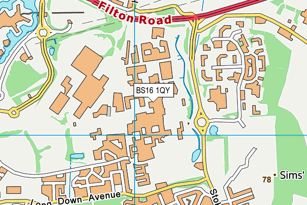
University of the West of England, Bristol is located in Frenchay, Bristol and falls under the local authority of South Gloucestershire. The type of establishment is higher education institutions. The most recend Ofsted inspection was 9th December 2022 resulting in an good rating.
| Address | University of the West of England, Bristol Coldharbour Lane Frenchay Bristol BS16 1QY |
| Website | https://www.uwe.ac.uk |
| Vice-Chancellor | Professor Steven West |
GetTheData
Source: Get Information About Schools
Licence: Open Government Licence
| Phase of Education | Not applicable |
| Type of Establishment | Higher education institutions |
| Admissions Policy | Not applicable |
| Boarders | No boarders |
| Official Sixth Form | Not applicable |
| Gender | Mixed |
| Diocese | Not applicable |
| Special Classes | Not applicable |
GetTheData
Source: Get Information About Schools
Licence: Open Government Licence
| Street Address | Coldharbour Lane |
| Locality | Frenchay |
| Town | Bristol |
| Postcode | BS16 1QY |
| ➜ More BS16 1QY open data | |
GetTheData
Source: Get Information About Schools
Licence: Open Government Licence

GetTheData
Source: OS VectorMap District (Ordnance Survey)
Licence: Open Government Licence (requires attribution)
| Ofsted Last Inspection | 9th December 2022 |
| Ofsted Rating | Good |
| Ofsted Special Measures | Not applicable |
GetTheData
Source: Get Information About Schools
Licence: Open Government Licence
| Establishment Name | University of the West of England, Bristol |
| Unique Reference Number | 133798 |
| Local Authority | South Gloucestershire |
| Local Authority Code | 803 |
| Previous Local Authority Code | 999 |
| Government Statistical Service Local Authority Code | E06000025 |
| Government Office Region | South West |
| District | South Gloucestershire |
| District Code | E06000025 |
| Ward | Stoke Park & Cheswick |
| Parliamentary Constituency | Filton and Bradley Stoke |
| Urban/Rural Description | (England/Wales) Urban city and town |
| Middle Super Output Area | South Gloucestershire 035 |
| Lower Super Output Area | South Gloucestershire 035C |
GetTheData
Source: Get Information About Schools
Licence: Open Government Licence
| Establishment Status | Open |
| Last Changed Date | 27th July 2023 |
| Reason Establishment Opened | Not applicable |
| Reason Establishment Closed | Not applicable |
GetTheData
Source: Get Information About Schools
Licence: Open Government Licence
| Teenage Mothers | Not applicable |
| Child Care Facilities | Not applicable |
| Special Educational Needs (SEN) Provision in Primary Care Unit | Not applicable |
| Pupil Referral Unit (PRU) Provides for Educational and Behavioural Difficulties (EBD) | Not applicable |
| Pupil Referral Unit (PRU) Offers Tuition by Another Provider | Not applicable |
GetTheData
Source: Get Information About Schools
Licence: Open Government Licence
| Section 41 Approved | Not applicable |
GetTheData
Source: Get Information About Schools
Licence: Open Government Licence
| Trust flag | Not applicable |
| School Sponsor flag | Not applicable |
GetTheData
Source: Get Information About Schools
Licence: Open Government Licence
| Federation flag | Not applicable |
GetTheData
Source: Get Information About Schools
Licence: Open Government Licence
| UK Provider Reference Number | 10007164 |
| Further Education/Higher Education Identifier | 81 |
| Further Education Type | Not applicable |
GetTheData
Source: Get Information About Schools
Licence: Open Government Licence
| Easting | 362093 |
| Northing | 178061 |
| Latitude | 51.50021 |
| Longitude | -2.54749 |
GetTheData
Source: Get Information About Schools
Licence: Open Government Licence
| School | Phase of Education | Distance |
|---|---|---|
| Wallscourt Farm Academy Long Down Avenue, Stoke Gifford, Bristol, BS16 1GE | Primary | 691m |
| Abbeywood Community School New Road, Stoke Gifford, Bristol, BS34 8SF | Secondary | 1.3km |
| South Gloucestershire Hospital Home Teaching Service School Room, Frenchay, Frenchay Hospital, Bristol, BS16 1LE | Not applicable | 1.4km |
| Begbrook Primary Academy Begbrook Drive, Stapleton, Bristol, BS16 1HG | Primary | 1.6km |
| Shield Road Primary School Shields Avenue, Northville, Bristol, BS7 0RR | Primary | 1.8km |
| Stoke Park Primary School Brangwyn Grove, Lockleaze, Bristol, BS7 9BY | Primary | 1.8km |
| Trinity Academy Romney Avenue, Lockleaze, Bristol, BS7 9BY | Secondary | 1.8km |
| Frenchay Church of England Primary School Alexander Road, Frenchay, BS16 1UZ | Primary | 1.9km |
| St Michael's Church of England Primary School, Stoke Gifford Ratcliffe Drive, Stoke Gifford, Bristol, BS34 8SG | Primary | 2km |
| Upper Horfield Primary School Upper Horfield Community School & Early Years, Sheridan Road, Horfield, Bristol, BS7 0PU | Primary | 2km |
GetTheData
Source: Get Information About Schools
Licence: Open Government Licence