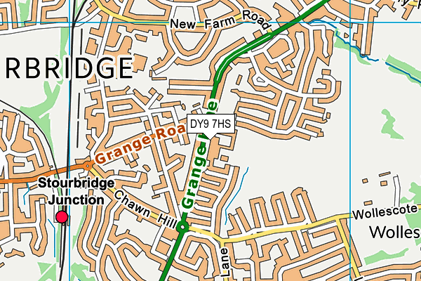
The Pedmore High School is located in Pedmore, Stourbridge and falls under the local authority of Dudley. This mixed-sex secondary school has 606 pupils, with a capacity of 787, aged from eleven up to sixteen, and the type of establishment is academy converter. The most recend Ofsted inspection was 15th February 2023 resulting in an good rating.
| Address | The Pedmore High School Grange Lane Pedmore Stourbridge West Midlands DY9 7HS |
| Website | http://www.pedmorehighschool.uk |
| Headteacher | Mr Gareth Lloyd |
GetTheData
Source: Get Information About Schools
Licence: Open Government Licence
| Phase of Education | Secondary |
| Type of Establishment | Academy converter |
| Admissions Policy | Non-selective |
| Statutory Low Age | 11 |
| Statutory High Age | 16 |
| Boarders | No boarders |
| Official Sixth Form | Does not have a sixth form |
| Gender | Mixed |
| Religious Character | None |
| Diocese | Not applicable |
| Special Classes | No Special Classes |
GetTheData
Source: Get Information About Schools
Licence: Open Government Licence
| Census Date | 19th January 2023 | |
| School Capacity | 787 | |
| Number of Pupils | 606 | 77% capacity |
| Number of Boys | 310 | 51% |
| Number of Girls | 296 | 49% |
| Free School Meals (%) | 35.30% |
GetTheData
Source: Get Information About Schools
Licence: Open Government Licence
| Street Address | Grange Lane |
| Locality | Pedmore |
| Town | Stourbridge |
| County | West Midlands |
| Postcode | DY9 7HS |
| ➜ More DY9 7HS open data | |
GetTheData
Source: Get Information About Schools
Licence: Open Government Licence

GetTheData
Source: OS VectorMap District (Ordnance Survey)
Licence: Open Government Licence (requires attribution)
| Ofsted Last Inspection | 15th February 2023 |
| Ofsted Rating | Good |
| Ofsted Special Measures | Not applicable |
GetTheData
Source: Get Information About Schools
Licence: Open Government Licence
| Establishment Name | The Pedmore High School |
| Establishment Number | 4105 |
| Unique Reference Number | 145593 |
| Local Authority | Dudley |
| Local Authority Code | 332 |
| Previous Local Authority Code | 999 |
| Government Statistical Service Local Authority Code | E08000027 |
| Government Office Region | West Midlands |
| District | Dudley |
| District Code | E08000027 |
| Ward | Pedmore and Stourbridge East |
| Parliamentary Constituency | Stourbridge |
| Urban/Rural Description | (England/Wales) Urban major conurbation |
| Middle Super Output Area | Dudley 042 |
| Lower Super Output Area | Dudley 042D |
GetTheData
Source: Get Information About Schools
Licence: Open Government Licence
| Establishment Status | Open |
| Last Changed Date | 23rd January 2024 |
| Reason Establishment Opened | Academy Converter |
| Open Date | 1st September 2018 |
GetTheData
Source: Get Information About Schools
Licence: Open Government Licence
| Teenage Mothers | Not applicable |
| Child Care Facilities | Not applicable |
| Special Educational Needs (SEN) Provision in Primary Care Unit | Not applicable |
| Pupil Referral Unit (PRU) Provides for Educational and Behavioural Difficulties (EBD) | Not applicable |
| Pupil Referral Unit (PRU) Offers Tuition by Another Provider | Not applicable |
GetTheData
Source: Get Information About Schools
Licence: Open Government Licence
| Section 41 Approved | Not applicable |
GetTheData
Source: Get Information About Schools
Licence: Open Government Licence
| Trust flag | Supported by a multi-academy trust |
| Trust | INVICTUS EDUCATION TRUST |
| School Sponsor flag | Linked to a sponsor |
| School Sponsor | Invictus Education Trust |
GetTheData
Source: Get Information About Schools
Licence: Open Government Licence
| Federation flag | Not applicable |
GetTheData
Source: Get Information About Schools
Licence: Open Government Licence
| UK Provider Reference Number | 10080889 |
| Further Education Type | Not applicable |
GetTheData
Source: Get Information About Schools
Licence: Open Government Licence
| Easting | 391502 |
| Northing | 283575 |
| Latitude | 52.45006 |
| Longitude | -2.12647 |
GetTheData
Source: Get Information About Schools
Licence: Open Government Licence
| School | Phase of Education | Distance |
|---|---|---|
| Rufford Primary School Bredon Avenue, Stourbridge, DY9 7NR | Primary | 659m |
| Ham Dingle Primary Academy Ham Dingle Primary School, Old Ham Lane, Pedmore, Stourbridge, DY9 0UN | Primary | 736m |
| Redhill School Junction Road, Stourbridge, DY8 1JX | Secondary | 992m |
| Hob Green Primary School Hob Green Road, Pedmore Fields, Stourbridge, DY9 9EX | Primary | 1km |
| Old Swinford Hospital Heath Lane, Stourbridge, DY8 1QX | Secondary | 1.2km |
| Oldswinford C of E Primary School Field Lane, Oldswinford, Stourbridge, DY8 2JQ | Primary | 1.2km |
| Wollescote Primary School Drummond Road, Wollescote, Stourbridge, DY9 8YA | Primary | 1.4km |
| Pedmore CE Primary School Hagley Road, Pedmore, Stourbridge, DY9 0RH | Primary | 1.5km |
| Elmfield Rudolf Steiner School Limited 14 Love Lane, Stourbridge, DY8 2EA | Not applicable | 1.5km |
| Peters Hill Primary School Peters Hill Road, Amblecote, Brierley Hill, DY5 2QH | Primary | 1.5km |
GetTheData
Source: Get Information About Schools
Licence: Open Government Licence