The Bridge Satellite Provision is located in London and falls under the local authority of Islington. This mixed-sex school has 29 pupils, with a capacity of 90, aged from four up to nineteen, and the type of establishment is free schools special. The most recend Ofsted inspection was 23rd February 2022 resulting in an good rating.
| Address | The Bridge Satellite Provision Duncombe Road London N19 3DL |
| Website | http://www.thebridgetrust.academy |
| Headteacher | Ms Rosie Whur |
GetTheData
Source: Get Information About Schools
Licence: Open Government Licence
| Phase of Education | Not applicable |
| Type of Establishment | Free schools special |
| Statutory Low Age | 4 |
| Statutory High Age | 19 |
| Boarders | Not applicable |
| Official Sixth Form | Has a sixth form |
| Gender | Mixed |
| Religious Character | None |
| Special Classes | Not applicable |
GetTheData
Source: Get Information About Schools
Licence: Open Government Licence
| Census Date | 19th January 2023 | |
| School Capacity | 90 | |
| Number of Pupils | 29 | 32% capacity |
| Number of Boys | 22 | 76% |
| Number of Girls | 7 | 24% |
| Free School Meals (%) | 69.00% |
GetTheData
Source: Get Information About Schools
Licence: Open Government Licence
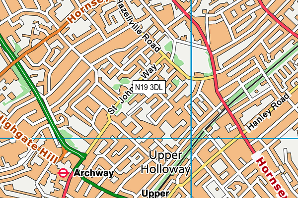
| Street Address | Duncombe Road |
| Town | London |
| Postcode | N19 3DL |
| ➜ More N19 3DL open data | |
GetTheData
Source: Get Information About Schools
Licence: Open Government Licence

GetTheData
Source: OS VectorMap District (Ordnance Survey)
Licence: Open Government Licence (requires attribution)
| LAESTAB | 2067002 |
| Ofsted Region | London |
GetTheData
Source: Ofsted: State-funded schools inspections and outcomes as at 31 March 2018: most recent inspection data at 31 March 2018
Licence: Open Government Licence
| Ofsted Last Inspection | 23rd February 2022 |
| Ofsted Rating | Good |
| Ofsted Special Measures | Not applicable |
GetTheData
Source: Get Information About Schools
Licence: Open Government Licence
| Establishment Name | The Bridge Satellite Provision |
| Establishment Number | 7002 |
| Previous Establishment Number | 4002 |
| Unique Reference Number | 143702 |
| Local Authority | Islington |
| Local Authority Code | 206 |
| Previous Local Authority Code | 999 |
| Government Statistical Service Local Authority Code | E09000019 |
| Government Office Region | London |
| District | Islington |
| District Code | E09000019 |
| Ward | Hillrise |
| Parliamentary Constituency | Islington North |
| Urban/Rural Description | (England/Wales) Urban major conurbation |
| Middle Super Output Area | Islington 002 |
| Lower Super Output Area | Islington 002E |
GetTheData
Source: Get Information About Schools
Licence: Open Government Licence
| Establishment Status | Open |
| Last Changed Date | 17th January 2024 |
| Open Date | 1st September 2017 |
GetTheData
Source: Get Information About Schools
Licence: Open Government Licence
| Teenage Mothers | Not applicable |
| Special Educational Needs (SEN) Provision in Primary Care Unit | Not applicable |
| Pupil Referral Unit (PRU) Provides for Educational and Behavioural Difficulties (EBD) | Not applicable |
GetTheData
Source: Get Information About Schools
Licence: Open Government Licence
| Section 41 Approved | Not applicable |
GetTheData
Source: Get Information About Schools
Licence: Open Government Licence
| Trust flag | Supported by a multi-academy trust |
| Trust | THE BRIDGE MAT LTD |
| School Sponsor flag | Linked to a sponsor |
| School Sponsor | The Bridge MAT Ltd |
GetTheData
Source: Get Information About Schools
Licence: Open Government Licence
| Federation flag | Not applicable |
GetTheData
Source: Get Information About Schools
Licence: Open Government Licence
| UK Provider Reference Number | 10065278 |
GetTheData
Source: Get Information About Schools
Licence: Open Government Licence
| Easting | 529977 |
| Northing | 184906 |
| Latitude | 51.54809 |
| Longitude | -0.12688 |
GetTheData
Source: Get Information About Schools
Licence: Open Government Licence
| School | Phase of Education | Distance |
|---|---|---|
| The Bridge School 251 Hungerford Road, London, N7 9LD | Not applicable | 0m |
| Hungerford School 249 Hungerford Road, Islington, London, N7 9LF | Primary | 70m |
| Brecknock Primary School Cliff Villas, Camden, London, NW1 9AL | Primary | 96m |
| Torriano Primary School Torriano Avenue, Kentish Town, London, NW5 2SJ | Primary | 450m |
| Robert Blair School and Children's Centre Brewery Road, Islington, London, N7 9QJ | Primary | 514m |
| The Camden School for Girls Sandall Road, London, NW5 2DB | Secondary | 590m |
| Beacon High Hilldrop Road, Islington, London, N7 0JG | Secondary | 653m |
| Tufnell Park Primary School 31 Carleton Road, London, N7 0HJ | Primary | 732m |
| Kentish Town Church of England Primary School Islip Street, London, NW5 2TU | Primary | 879m |
| Sacred Heart Catholic Primary School 68 Georges Road, Holloway, London, N7 8JN | Primary | 959m |
GetTheData
Source: Get Information About Schools
Licence: Open Government Licence