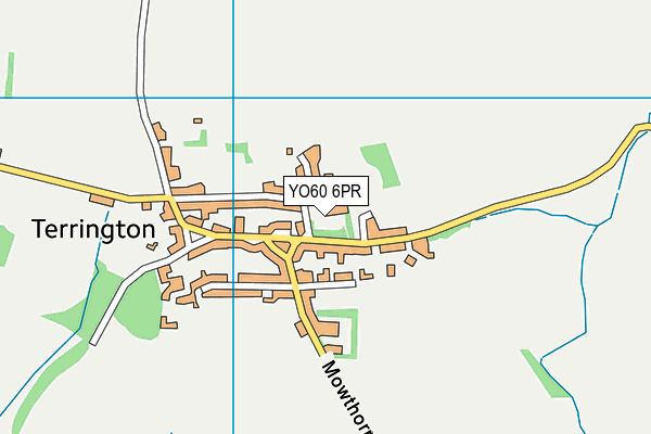
Terrington Hall School is located in York, York and falls under the local authority of North Yorkshire. This mixed-sex school has 185 pupils, with a capacity of 201, aged from two up to fourteen, and the type of establishment is other independent school.
| Address | Terrington Hall School Terrington York North Yorkshire York North Yorkshire YO60 6PR |
| Website | http://www.terringtonhall.com |
| Headteacher | Mr Simon Kibler |
GetTheData
Source: Get Information About Schools
Licence: Open Government Licence
| Phase of Education | Not applicable |
| Type of Establishment | Other independent school |
| Admissions Policy | Not applicable |
| Statutory Low Age | 2 |
| Statutory High Age | 14 |
| Boarders | Boarding school |
| Boarding Establishment | Has boarders |
| Official Sixth Form | Does not have a sixth form |
| Gender | Mixed |
| Religious Character | None |
| Diocese | Not applicable |
| Special Classes | No Special Classes |
GetTheData
Source: Get Information About Schools
Licence: Open Government Licence
| Census Date | 20th January 2022 | |
| School Capacity | 201 | |
| Number of Pupils | 185 | 92% capacity |
| Number of Boys | 87 | 47% |
| Number of Girls | 98 | 53% |
| Free School Meals (%) | 0.0% |
GetTheData
Source: Get Information About Schools
Licence: Open Government Licence
| Street Address | Terrington |
| Locality | York |
| Address 3 | North Yorkshire |
| Town | York |
| County | North Yorkshire |
| Postcode | YO60 6PR |
| ➜ More YO60 6PR open data | |
GetTheData
Source: Get Information About Schools
Licence: Open Government Licence

GetTheData
Source: OS VectorMap District (Ordnance Survey)
Licence: Open Government Licence (requires attribution)
| Ofsted Special Measures | Not applicable |
GetTheData
Source: Get Information About Schools
Licence: Open Government Licence
| Establishment Name | Terrington Hall School |
| Establishment Number | 6003 |
| Previous Establishment Number | 6013 |
| Unique Reference Number | 121732 |
| Local Authority | North Yorkshire |
| Local Authority Code | 815 |
| Previous Local Authority | Pre LGR (1996) North Yorkshire |
| Previous Local Authority Code | 927 |
| Government Statistical Service Local Authority Code | E06000065 |
| Government Office Region | Yorkshire and the Humber |
| District | North Yorkshire |
| District Code | E06000065 |
| Ward | Amotherby & Ampleforth |
| Parliamentary Constituency | Thirsk and Malton |
| Urban/Rural Description | (England/Wales) Rural village |
| Middle Super Output Area | Ryedale 007 |
| Lower Super Output Area | Ryedale 007C |
GetTheData
Source: Get Information About Schools
Licence: Open Government Licence
| Establishment Status | Open |
| Last Changed Date | 26th September 2023 |
| Reason Establishment Opened | Not applicable |
| Open Date | 1st January 1939 |
| Reason Establishment Closed | Not applicable |
GetTheData
Source: Get Information About Schools
Licence: Open Government Licence
| Teenage Mothers | Not applicable |
| Child Care Facilities | Not applicable |
| Special Educational Needs (SEN) Provision in Primary Care Unit | Not applicable |
| Pupil Referral Unit (PRU) Provides for Educational and Behavioural Difficulties (EBD) | Not applicable |
| Pupil Referral Unit (PRU) Offers Tuition by Another Provider | Not applicable |
GetTheData
Source: Get Information About Schools
Licence: Open Government Licence
| Section 41 Approved | Not approved |
GetTheData
Source: Get Information About Schools
Licence: Open Government Licence
| Trust flag | Not applicable |
| School Sponsor flag | Not applicable |
GetTheData
Source: Get Information About Schools
Licence: Open Government Licence
| Federation flag | Not applicable |
GetTheData
Source: Get Information About Schools
Licence: Open Government Licence
| UK Provider Reference Number | 10017784 |
| Further Education Type | Not applicable |
GetTheData
Source: Get Information About Schools
Licence: Open Government Licence
| Easting | 467215 |
| Northing | 470725 |
| Latitude | 54.12799 |
| Longitude | -0.97294 |
GetTheData
Source: Get Information About Schools
Licence: Open Government Licence
| School | Phase of Education | Distance |
|---|---|---|
| Terrington Church of England Voluntary Aided Primary School North Back Lane, Terrington, York, YO60 6NS | Primary | 205m |
| Slingsby Community Primary School The Green, Slingsby, York, YO62 4AA | Primary | 4.8km |
| Sheriff Hutton Primary School West End, Sheriff Hutton, York, YO60 6SH | Primary | 4.9km |
| Welburn Community Primary School Welburn, York, YO60 7DX | Primary | 5.4km |
| Foston Church of England Voluntary Controlled Primary School Main Street, Foston, York, YO60 7QB | Primary | 5.9km |
| Amotherby Community Primary School Meadowfield, Amotherby, Malton, YO17 6TG | Primary | 8.1km |
| Stillington Primary School Main Street, Stillington, York, YO61 1LA | Primary | 9.3km |
| Sutton on the Forest Church of England Voluntary Controlled Primary School Main Street, Sutton-on-the-Forest, York, YO61 1DW | Primary | 10.5km |
| Ampleforth College Ampleforth, York, YO62 4ER | Not applicable | 10.9km |
| St Benedict's Catholic Primary School - a Catholic voluntary academy Back Lane, Ampleforth, York, YO62 4DE | Primary | 11.7km |
GetTheData
Source: Get Information About Schools
Licence: Open Government Licence