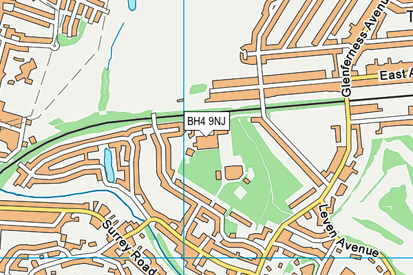
Talbot Heath School is located in BOURNEMOUTH, Bournemouth and falls under the local authority of Bournemouth, Christchurch and Poole. The school's religious denomination is Church of England. This girls only school has 581 pupils, with a capacity of 619, aged from three up to nineteen, and the type of establishment is other independent school.
| Address | Talbot Heath School Rothesay Road BOURNEMOUTH Bournemouth Dorset BH4 9NJ |
| Website | http://www.talbotheath.org |
| Headteacher | Mrs Tracy Harris |
GetTheData
Source: Get Information About Schools
Licence: Open Government Licence
| Phase of Education | Not applicable |
| Type of Establishment | Other independent school |
| Admissions Policy | Not applicable |
| Statutory Low Age | 3 |
| Statutory High Age | 19 |
| Boarders | Boarding school |
| Boarding Establishment | Has boarders |
| Official Sixth Form | Has a sixth form |
| Gender | Girls |
| Religious Character | Church of England |
| Diocese | Not applicable |
| Special Classes | No Special Classes |
GetTheData
Source: Get Information About Schools
Licence: Open Government Licence
| Census Date | 20th January 2022 | |
| School Capacity | 619 | |
| Number of Pupils | 581 | 94% capacity |
| Number of Girls | 581 | |
| Free School Meals (%) | 0.0% |
GetTheData
Source: Get Information About Schools
Licence: Open Government Licence
| Street Address | Rothesay Road |
| Locality | BOURNEMOUTH |
| Town | Bournemouth |
| County | Dorset |
| Postcode | BH4 9NJ |
| ➜ More BH4 9NJ open data | |
GetTheData
Source: Get Information About Schools
Licence: Open Government Licence

GetTheData
Source: OS VectorMap District (Ordnance Survey)
Licence: Open Government Licence (requires attribution)
| Ofsted Special Measures | Not applicable |
GetTheData
Source: Get Information About Schools
Licence: Open Government Licence
| Establishment Name | Talbot Heath School |
| Establishment Number | 6007 |
| Previous Establishment Number | 6001 |
| Unique Reference Number | 113945 |
| Local Authority | Bournemouth, Christchurch and Poole |
| Local Authority Code | 839 |
| Previous Local Authority | Pre-LGR 2019 Bournemouth |
| Previous Local Authority Code | 837 |
| Government Statistical Service Local Authority Code | X999999 |
| Government Office Region | South West |
| District | Bournemouth, Christchurch and Poole |
| District Code | E06000058 |
| Ward | Talbot & Branksome Woods |
| Parliamentary Constituency | Bournemouth West |
| Urban/Rural Description | (England/Wales) Urban city and town |
| Middle Super Output Area | Bournemouth, Christchurch and Poole 028 |
| Lower Super Output Area | Bournemouth, Christchurch and Poole 028A |
GetTheData
Source: Get Information About Schools
Licence: Open Government Licence
| Establishment Status | Open |
| Last Changed Date | 8th November 2023 |
| Reason Establishment Opened | Not applicable |
| Open Date | 30th September 1980 |
| Reason Establishment Closed | Not applicable |
GetTheData
Source: Get Information About Schools
Licence: Open Government Licence
| Teenage Mothers | Not applicable |
| Child Care Facilities | Not applicable |
| Special Educational Needs (SEN) Provision in Primary Care Unit | Not applicable |
| Pupil Referral Unit (PRU) Provides for Educational and Behavioural Difficulties (EBD) | Not applicable |
| Pupil Referral Unit (PRU) Offers Tuition by Another Provider | Not applicable |
GetTheData
Source: Get Information About Schools
Licence: Open Government Licence
| Section 41 Approved | Not approved |
GetTheData
Source: Get Information About Schools
Licence: Open Government Licence
| Trust flag | Not applicable |
| School Sponsor flag | Not applicable |
GetTheData
Source: Get Information About Schools
Licence: Open Government Licence
| Federation flag | Not applicable |
GetTheData
Source: Get Information About Schools
Licence: Open Government Licence
| UK Provider Reference Number | 10006488 |
| Further Education Type | Not applicable |
GetTheData
Source: Get Information About Schools
Licence: Open Government Licence
| Easting | 407086 |
| Northing | 92434 |
| Latitude | 50.73148 |
| Longitude | -1.90097 |
GetTheData
Source: Get Information About Schools
Licence: Open Government Licence
| School | Phase of Education | Distance |
|---|---|---|
| Bishop Aldhelm's Church of England Primary School Winston Avenue, Branksome, Poole, BH12 1PG | Primary | 694m |
| Arts University Bournemouth Wallisdown Road, Poole, BH12 5HH | Not applicable | 1.2km |
| Bournemouth University Poole House, Talbot Campus, Fern Barrow, Poole, BH12 5BB | Not applicable | 1.3km |
| Talbot Primary School Talbot Drive, Wallisdown, Poole, BH12 5ED | Primary | 1.4km |
| Langside School Langside Avenue, Parkstone, Poole, BH12 5BN | Not applicable | 1.4km |
| Victoria Education Centre 12 Lindsay Road, Branksome Park, Poole, BH13 6AS | Not applicable | 1.4km |
| Talbot House School 8 Firs Glen Road, Winton, Bournemouth, BH9 2LR | Not applicable | 1.6km |
| St Mark's Church of England Primary School Talbot Village, Bournemouth, BH10 4JA | Primary | 1.6km |
| St Michael's Church of England Primary School Somerville Road, Bournemouth, BH2 5LH | Primary | 1.6km |
| Kings Bournemouth 58 Braidley Road, Bournemouth, BH2 6LD | Not applicable | 1.7km |
GetTheData
Source: Get Information About Schools
Licence: Open Government Licence