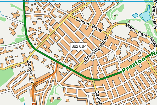
St Silas's CofE Primary School is located in Blackburn and falls under the local authority of Blackburn with Darwen. The school's religious denomination is Church of England. This mixed-sex primary school has 323 pupils, with a capacity of 420, aged from five up to eleven, and the type of establishment is academy sponsor led. The most recend Ofsted inspection was 26th April 2023 resulting in an good rating.
| Address | St Silas's CofE Primary School St Silas Road Blackburn Lancashire BB2 6JP |
| Website | https://www.stsilasprimary.co.uk |
| Headteacher | Mrs Michele Battersby |
GetTheData
Source: Get Information About Schools
Licence: Open Government Licence
| Phase of Education | Primary |
| Type of Establishment | Academy sponsor led |
| Admissions Policy | Not applicable |
| Statutory Low Age | 5 |
| Statutory High Age | 11 |
| Boarders | No boarders |
| Official Sixth Form | Does not have a sixth form |
| Gender | Mixed |
| Religious Character | Church of England |
| Diocese | Diocese of Blackburn |
| Special Classes | Not applicable |
GetTheData
Source: Get Information About Schools
Licence: Open Government Licence
| Census Date | 19th January 2023 | |
| School Capacity | 420 | |
| Number of Pupils | 323 | 77% capacity |
| Number of Boys | 172 | 53% |
| Number of Girls | 151 | 47% |
| Free School Meals (%) | 21.10% |
GetTheData
Source: Get Information About Schools
Licence: Open Government Licence
| Street Address | St Silas Road |
| Town | Blackburn |
| County | Lancashire |
| Postcode | BB2 6JP |
| ➜ More BB2 6JP open data | |
GetTheData
Source: Get Information About Schools
Licence: Open Government Licence

GetTheData
Source: OS VectorMap District (Ordnance Survey)
Licence: Open Government Licence (requires attribution)
| Ofsted Last Inspection | 26th April 2023 |
| Ofsted Rating | Good |
| Ofsted Special Measures | Not applicable |
GetTheData
Source: Get Information About Schools
Licence: Open Government Licence
| Establishment Name | St Silas's CofE Primary School |
| Establishment Number | 2014 |
| Unique Reference Number | 146541 |
| Local Authority | Blackburn with Darwen |
| Local Authority Code | 889 |
| Previous Local Authority Code | 999 |
| Government Statistical Service Local Authority Code | E06000008 |
| Government Office Region | North West |
| District | Blackburn with Darwen |
| District Code | E06000008 |
| Ward | Billinge & Beardwood |
| Parliamentary Constituency | Blackburn |
| Urban/Rural Description | (England/Wales) Urban city and town |
| Middle Super Output Area | Blackburn with Darwen 002 |
| Lower Super Output Area | Blackburn with Darwen 002E |
GetTheData
Source: Get Information About Schools
Licence: Open Government Licence
| Establishment Status | Open |
| Last Changed Date | 24th January 2024 |
| Reason Establishment Opened | New Provision |
| Open Date | 1st December 2018 |
GetTheData
Source: Get Information About Schools
Licence: Open Government Licence
| Teenage Mothers | Not applicable |
| Special Educational Needs (SEN) Provision in Primary Care Unit | Not applicable |
| Pupil Referral Unit (PRU) Provides for Educational and Behavioural Difficulties (EBD) | Not applicable |
GetTheData
Source: Get Information About Schools
Licence: Open Government Licence
| Section 41 Approved | Not applicable |
GetTheData
Source: Get Information About Schools
Licence: Open Government Licence
| Trust flag | Supported by a multi-academy trust |
| Trust | CIDARI EDUCATION LIMITED |
| School Sponsor flag | Linked to a sponsor |
| School Sponsor | Cidari Trust |
GetTheData
Source: Get Information About Schools
Licence: Open Government Licence
| Federation flag | Not applicable |
GetTheData
Source: Get Information About Schools
Licence: Open Government Licence
| UK Provider Reference Number | 10081447 |
GetTheData
Source: Get Information About Schools
Licence: Open Government Licence
| Easting | 366831 |
| Northing | 428553 |
| Latitude | 53.75228 |
| Longitude | -2.5045 |
GetTheData
Source: Get Information About Schools
Licence: Open Government Licence
| School | Phase of Education | Distance |
|---|---|---|
| Sacred Heart Roman Catholic Primary School Blackburn Lynwood Road, Blackburn, BB2 6HQ | Primary | 132m |
| Dar Ul Madinah Granville Road, Blackburn, Lancashire, BB2 6HD | Not applicable | 212m |
| Wensley Fold CofE Primary Academy Manor Road, Blackburn, BB2 6LX | Primary | 532m |
| Queen Elizabeth's Primary School West Park Road, QEGS West Park Rd, Blackburn, BB2 6DF | Primary | 575m |
| Queen Elizabeth's Grammar School West Park Road, Blackburn, BB2 6DF | Secondary | 576m |
| Tauheedul Islam Girls' High School Preston New Road, Blackburn, BB2 7AD | Secondary | 606m |
| The Olive School Blackburn Meins Road, Blackburn, BB2 6QQ | Primary | 696m |
| Ashworth Nursery School Addison Close, Addison Close, Blackburn, BB2 1QU | Nursery | 851m |
| St Barnabas and St Paul's Church of England Voluntary Aided Primary School Oakenhurst Road, Blackburn, BB2 1SN | Primary | 892m |
| Blackburn College Blackburn College, Harrison Centre, Feilden Street, Blackburn, BB2 1LH | 16 plus | 1.1km |
GetTheData
Source: Get Information About Schools
Licence: Open Government Licence