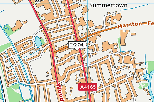
St Clare's, Oxford is located in Oxford and falls under the local authority of Oxfordshire. This mixed-sex school has 230 pupils, with a capacity of 318, aged from fifteen up to nineteen, and the type of establishment is other independent school.
| Address | St Clare's, Oxford 139 Banbury Road Oxford Oxfordshire OX2 7AL |
| Website | http://www.stclares.ac.uk |
| Headteacher | Mr Duncan Reith |
GetTheData
Source: Get Information About Schools
Licence: Open Government Licence
| Phase of Education | Not applicable |
| Type of Establishment | Other independent school |
| Admissions Policy | Selective |
| Statutory Low Age | 15 |
| Statutory High Age | 19 |
| Boarders | Boarding school |
| Boarding Establishment | Has boarders |
| Official Sixth Form | Has a sixth form |
| Gender | Mixed |
| Religious Character | None |
| Diocese | Not applicable |
| Special Classes | Not applicable |
GetTheData
Source: Get Information About Schools
Licence: Open Government Licence
| Census Date | 20th January 2022 | |
| School Capacity | 318 | |
| Number of Pupils | 230 | 72% capacity |
| Number of Boys | 90 | 39% |
| Number of Girls | 140 | 61% |
| Free School Meals (%) | 0.0% |
GetTheData
Source: Get Information About Schools
Licence: Open Government Licence
| Street Address | 139 Banbury Road |
| Town | Oxford |
| County | Oxfordshire |
| Postcode | OX2 7AL |
| ➜ More OX2 7AL open data | |
GetTheData
Source: Get Information About Schools
Licence: Open Government Licence

GetTheData
Source: OS VectorMap District (Ordnance Survey)
Licence: Open Government Licence (requires attribution)
| Ofsted Special Measures | Not applicable |
GetTheData
Source: Get Information About Schools
Licence: Open Government Licence
| Establishment Name | St Clare's, Oxford |
| Establishment Number | 6120 |
| Unique Reference Number | 133430 |
| Local Authority | Oxfordshire |
| Local Authority Code | 931 |
| Previous Local Authority Code | 999 |
| Government Statistical Service Local Authority Code | E10000025 |
| Government Office Region | South East |
| District | Oxford |
| District Code | E07000178 |
| Ward | Summertown |
| Parliamentary Constituency | Oxford West and Abingdon |
| Urban/Rural Description | (England/Wales) Urban city and town |
| Middle Super Output Area | Oxford 003 |
| Lower Super Output Area | Oxford 003E |
GetTheData
Source: Get Information About Schools
Licence: Open Government Licence
| Establishment Status | Open |
| Last Changed Date | 28th November 2023 |
| Reason Establishment Opened | Not applicable |
| Open Date | 12th September 1953 |
| Reason Establishment Closed | Not applicable |
GetTheData
Source: Get Information About Schools
Licence: Open Government Licence
| Teenage Mothers | Not applicable |
| Child Care Facilities | Not applicable |
| Special Educational Needs (SEN) Provision in Primary Care Unit | Not applicable |
| Pupil Referral Unit (PRU) Provides for Educational and Behavioural Difficulties (EBD) | Not applicable |
| Pupil Referral Unit (PRU) Offers Tuition by Another Provider | Not applicable |
GetTheData
Source: Get Information About Schools
Licence: Open Government Licence
| Section 41 Approved | Not approved |
GetTheData
Source: Get Information About Schools
Licence: Open Government Licence
| Trust flag | Not applicable |
| School Sponsor flag | Not applicable |
GetTheData
Source: Get Information About Schools
Licence: Open Government Licence
| Federation flag | Not applicable |
GetTheData
Source: Get Information About Schools
Licence: Open Government Licence
| UK Provider Reference Number | 10008508 |
| Further Education Type | Not applicable |
GetTheData
Source: Get Information About Schools
Licence: Open Government Licence
| Easting | 450901 |
| Northing | 208546 |
| Latitude | 51.77328 |
| Longitude | -1.26369 |
GetTheData
Source: Get Information About Schools
Licence: Open Government Licence
| School | Phase of Education | Distance |
|---|---|---|
| Oxford High School Belbroughton Road, Oxford, OX26 1BY | Not applicable | 310m |
| The Cherwell School Marston Ferry Road, Oxford, OX2 7EE | Secondary | 457m |
| St Edward's School Woodstock Road, Oxford, OX2 7NN | Not applicable | 506m |
| Summer Fields School Mayfield Road, Oxford, OX2 7EN | Not applicable | 526m |
| Northern House Academy South Parade, Oxford, OX2 7JN | Not applicable | 627m |
| St Aloysius' Catholic Primary School 143 Woodstock Road, Oxford, OX2 7PH | Primary | 704m |
| Wychwood School 72-74 Banbury Road, Oxford, OX2 6JR | Not applicable | 733m |
| Dragon School Bardwell Road, Oxford, OX2 6SS | Not applicable | 776m |
| St Philip and James' Church of England Aided Primary School Oxford Navigation Way, Oxford, OX2 6AB | Primary | 834m |
| d'Overbroeck's 333 Banbury Road, Oxford, Oxfordshire, Oxford, OX2 7PL | Not applicable | 1.1km |
GetTheData
Source: Get Information About Schools
Licence: Open Government Licence