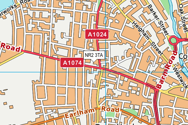
Notre Dame Preparatory School (Norwich) Limited is located in Norwich and falls under the local authority of Norfolk. The school's religious denomination is Roman Catholic. This mixed-sex school has 169 pupils, with a capacity of 220, aged from two up to eleven, and the type of establishment is other independent school.
| Address | Notre Dame Preparatory School (Norwich) Limited 147 Dereham Road Norwich Norfolk NR2 3TA |
| Website | http://www.notredameprepschool.co.uk |
| Headteacher | Mr Robert Thornton |
GetTheData
Source: Get Information About Schools
Licence: Open Government Licence
| Phase of Education | Not applicable |
| Type of Establishment | Other independent school |
| Admissions Policy | Non-selective |
| Statutory Low Age | 2 |
| Statutory High Age | 11 |
| Boarders | No boarders |
| Boarding Establishment | Does not have boarders |
| Official Sixth Form | Does not have a sixth form |
| Gender | Mixed |
| Religious Character | Roman Catholic |
| Diocese | Not applicable |
| Special Classes | No Special Classes |
GetTheData
Source: Get Information About Schools
Licence: Open Government Licence
| Census Date | 20th January 2022 | |
| School Capacity | 220 | |
| Number of Pupils | 169 | 77% capacity |
| Number of Boys | 82 | 49% |
| Number of Girls | 87 | 51% |
GetTheData
Source: Get Information About Schools
Licence: Open Government Licence
| Street Address | 147 Dereham Road |
| Town | Norwich |
| County | Norfolk |
| Postcode | NR2 3TA |
| ➜ More NR2 3TA open data | |
GetTheData
Source: Get Information About Schools
Licence: Open Government Licence

GetTheData
Source: OS VectorMap District (Ordnance Survey)
Licence: Open Government Licence (requires attribution)
| Ofsted Special Measures | Not applicable |
GetTheData
Source: Get Information About Schools
Licence: Open Government Licence
| Establishment Name | Notre Dame Preparatory School (Norwich) Limited |
| Establishment Number | 6114 |
| Unique Reference Number | 121239 |
| Local Authority | Norfolk |
| Local Authority Code | 926 |
| Previous Local Authority Code | 999 |
| Government Statistical Service Local Authority Code | E10000020 |
| Government Office Region | East of England |
| District | Norwich |
| District Code | E07000148 |
| Ward | Wensum |
| Parliamentary Constituency | Norwich South |
| Urban/Rural Description | (England/Wales) Urban city and town |
| Middle Super Output Area | Norwich 016 |
| Lower Super Output Area | Norwich 016C |
GetTheData
Source: Get Information About Schools
Licence: Open Government Licence
| Establishment Status | Open |
| Last Changed Date | 29th November 2023 |
| Reason Establishment Opened | Not applicable |
| Open Date | 1st January 1963 |
| Reason Establishment Closed | Not applicable |
GetTheData
Source: Get Information About Schools
Licence: Open Government Licence
| Teenage Mothers | Not applicable |
| Child Care Facilities | Not applicable |
| Special Educational Needs (SEN) Provision in Primary Care Unit | Not applicable |
| Pupil Referral Unit (PRU) Provides for Educational and Behavioural Difficulties (EBD) | Not applicable |
| Pupil Referral Unit (PRU) Offers Tuition by Another Provider | Not applicable |
GetTheData
Source: Get Information About Schools
Licence: Open Government Licence
| Section 41 Approved | Not approved |
GetTheData
Source: Get Information About Schools
Licence: Open Government Licence
| Trust flag | Not applicable |
| School Sponsor flag | Not applicable |
GetTheData
Source: Get Information About Schools
Licence: Open Government Licence
| Federation flag | Not applicable |
GetTheData
Source: Get Information About Schools
Licence: Open Government Licence
| UK Provider Reference Number | 10071109 |
| Further Education Type | Not applicable |
GetTheData
Source: Get Information About Schools
Licence: Open Government Licence
| Easting | 621874 |
| Northing | 309104 |
| Latitude | 52.6343 |
| Longitude | 1.27741 |
GetTheData
Source: Get Information About Schools
Licence: Open Government Licence
| School | Phase of Education | Distance |
|---|---|---|
| Nelson Infant School Northumberland Street, Norwich, NR2 4EH | Primary | 416m |
| Red Balloon - Norwich 289 Drayton Road, Norwich, NR3 2PW | Not applicable | 457m |
| Wensum Junior School Turner Road, Norwich, NR2 4HB | Primary | 764m |
| Recreation Road Infant School Recreation Road, Norwich, NR2 3PA | Primary | 822m |
| The Parkside School, Norwich College Road, Norwich, NR2 3JA | Not applicable | 864m |
| Avenue Junior School Avenue Road, Norwich, NR2 3HP | Primary | 952m |
| Jane Austen College 46-48 Colegate, Norwich, NR3 1DD | Secondary | 1.1km |
| Sir Isaac Newton Sixth Form Free School The Old Fire Station, 30 Bethel Street, Norwich, NR2 1NR | 16 plus | 1.1km |
| Bignold Primary School and Nursery Wessex Street, Norwich, NR2 2SY | Primary | 1.3km |
| Norwich University of the Arts Francis House, 3 - 7 Redwell Street, Norwich, NR2 4SN | Not applicable | 1.4km |
GetTheData
Source: Get Information About Schools
Licence: Open Government Licence