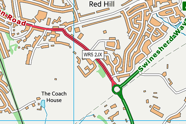
New College Worcester (NMSS) is located in Worcester and falls under the local authority of Worcestershire. This mixed-sex school has 70 pupils, with a capacity of 96, aged from eleven up to nineteen, and the type of establishment is non-maintained special school. The most recend Ofsted inspection was 28th April 2022 resulting in an serious weaknesses rating.
| Address | New College Worcester (NMSS) Whittington Road Worcester Worcestershire WR5 2JX |
| Website | http://www.ncw.co.uk |
| Principal | Mrs Rachel Perks |
GetTheData
Source: Get Information About Schools
Licence: Open Government Licence
| Phase of Education | Not applicable |
| Type of Establishment | Non-maintained special school |
| Admissions Policy | Not applicable |
| Statutory Low Age | 11 |
| Statutory High Age | 19 |
| Boarders | Boarding school |
| Official Sixth Form | Has a sixth form |
| Gender | Mixed |
| Religious Character | Does not apply |
| Diocese | Not applicable |
| Special Classes | Has Special Classes |
GetTheData
Source: Get Information About Schools
Licence: Open Government Licence
| Census Date | 19th January 2023 | |
| School Capacity | 96 | |
| Number of Pupils | 70 | 73% capacity |
| Number of Boys | 37 | 53% |
| Number of Girls | 33 | 47% |
| Free School Meals (%) | 20.00% |
GetTheData
Source: Get Information About Schools
Licence: Open Government Licence
| Street Address | Whittington Road |
| Town | Worcester |
| County | Worcestershire |
| Postcode | WR5 2JX |
| ➜ More WR5 2JX open data | |
GetTheData
Source: Get Information About Schools
Licence: Open Government Licence

GetTheData
Source: OS VectorMap District (Ordnance Survey)
Licence: Open Government Licence (requires attribution)
| Ofsted Last Inspection | 28th April 2022 |
| Ofsted Rating | Serious Weaknesses |
| Ofsted Special Measures | Not applicable |
GetTheData
Source: Get Information About Schools
Licence: Open Government Licence
| Establishment Name | New College Worcester (NMSS) |
| Establishment Number | 7019 |
| Previous Establishment Number | 7019 |
| Unique Reference Number | 117064 |
| Local Authority | Worcestershire |
| Local Authority Code | 885 |
| Previous Local Authority | Pre LGR (1998) Hereford & Worcester |
| Previous Local Authority Code | 918 |
| Government Statistical Service Local Authority Code | E10000034 |
| Government Office Region | West Midlands |
| District | Worcester |
| District Code | E07000237 |
| Ward | Battenhall |
| Parliamentary Constituency | Worcester |
| Urban/Rural Description | (England/Wales) Urban city and town |
| Middle Super Output Area | Worcester 013 |
| Lower Super Output Area | Worcester 013B |
GetTheData
Source: Get Information About Schools
Licence: Open Government Licence
| Establishment Status | Open |
| Last Changed Date | 6th December 2023 |
| Reason Establishment Opened | Not applicable |
| Reason Establishment Closed | Not applicable |
GetTheData
Source: Get Information About Schools
Licence: Open Government Licence
| Teenage Mothers | Not applicable |
| Child Care Facilities | Not applicable |
| Special Educational Needs (SEN) Provision in Primary Care Unit | Not applicable |
| Pupil Referral Unit (PRU) Provides for Educational and Behavioural Difficulties (EBD) | Not applicable |
| Pupil Referral Unit (PRU) Offers Tuition by Another Provider | Not applicable |
GetTheData
Source: Get Information About Schools
Licence: Open Government Licence
| Section 41 Approved | Not applicable |
| Special Educational Needs (SEN) Priority 1 | VI - Visual Impairment |
GetTheData
Source: Get Information About Schools
Licence: Open Government Licence
| Trust flag | Not applicable |
| School Sponsor flag | Not applicable |
GetTheData
Source: Get Information About Schools
Licence: Open Government Licence
| Federation flag | Not applicable |
GetTheData
Source: Get Information About Schools
Licence: Open Government Licence
| UK Provider Reference Number | 10040382 |
| Further Education Type | Not applicable |
GetTheData
Source: Get Information About Schools
Licence: Open Government Licence
| Easting | 387106 |
| Northing | 253501 |
| Latitude | 52.17961 |
| Longitude | -2.18999 |
GetTheData
Source: Get Information About Schools
Licence: Open Government Licence
| School | Phase of Education | Distance |
|---|---|---|
| Nunnery Wood High School Spetchley Road, Worcester, WR5 2LT | Secondary | 491m |
| Worcester Sixth Form College Spetchley Road, Worcester, WR5 2LU | 16 plus | 533m |
| Nunnery Wood Primary School Prestwich Avenue, Worcester, WR5 1QE | Primary | 701m |
| Whittington CofE Primary School Whittington, Worcester, WR5 2QZ | Primary | 914m |
| Red Hill CofE Primary School Midhurst Close, Worcester, WR5 2HX | Primary | 1km |
| Blessed Edward Oldcorne Catholic College Timberdine Avenue, Worcester, WR5 2XD | Secondary | 1.5km |
| Cherry Orchard Primary School Timberdine Close, Worcester, WR5 2DD | Primary | 1.5km |
| Perry Wood Primary and Nursery School St Albans Close, Worcester, WR5 1PP | Primary | 1.5km |
| Fort Royal Wyld's Lane, Worcester, WR5 1DR | Not applicable | 1.7km |
| Newbridge School Midland Road, Worcester, WR5 1DS | Not applicable | 1.8km |
GetTheData
Source: Get Information About Schools
Licence: Open Government Licence