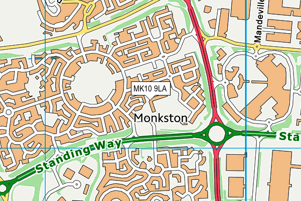
Monkston Primary School is located in Monkston, Milton Keynes and falls under the local authority of Milton Keynes. This mixed-sex primary school has 421 pupils, with a capacity of 420, aged from four up to eleven, and the type of establishment is academy converter. The most recend Ofsted inspection was 10th November 2021 resulting in an good rating.
| Address | Monkston Primary School Wadhurst Lane Monkston Milton Keynes Buckinghamshire MK10 9LA |
| Website | http://www.monkston.org |
| Headteacher | Mrs Hannah Williams |
GetTheData
Source: Get Information About Schools
Licence: Open Government Licence
| Phase of Education | Primary |
| Type of Establishment | Academy converter |
| Admissions Policy | Not applicable |
| Statutory Low Age | 4 |
| Statutory High Age | 11 |
| Boarders | No boarders |
| Official Sixth Form | Does not have a sixth form |
| Gender | Mixed |
| Religious Character | Does not apply |
| Diocese | Not applicable |
| Special Classes | Not applicable |
GetTheData
Source: Get Information About Schools
Licence: Open Government Licence
| Census Date | 19th January 2023 | |
| School Capacity | 420 | |
| Number of Pupils | 421 | 100% capacity |
| Number of Boys | 217 | 52% |
| Number of Girls | 204 | 48% |
| Free School Meals (%) | 12.60% |
GetTheData
Source: Get Information About Schools
Licence: Open Government Licence
| Street Address | Wadhurst Lane |
| Locality | Monkston |
| Town | Milton Keynes |
| County | Buckinghamshire |
| Postcode | MK10 9LA |
| ➜ More MK10 9LA open data | |
GetTheData
Source: Get Information About Schools
Licence: Open Government Licence

GetTheData
Source: OS VectorMap District (Ordnance Survey)
Licence: Open Government Licence (requires attribution)
| Ofsted Last Inspection | 10th November 2021 |
| Ofsted Rating | Good |
| Ofsted Special Measures | Not applicable |
GetTheData
Source: Get Information About Schools
Licence: Open Government Licence
| Establishment Name | Monkston Primary School |
| Establishment Number | 2008 |
| Unique Reference Number | 144137 |
| Local Authority | Milton Keynes |
| Local Authority Code | 826 |
| Previous Local Authority Code | 999 |
| Government Statistical Service Local Authority Code | E06000042 |
| Government Office Region | South East |
| District | Milton Keynes |
| District Code | E06000042 |
| Ward | Monkston |
| Parliamentary Constituency | Milton Keynes North |
| Urban/Rural Description | (England/Wales) Urban city and town |
| Middle Super Output Area | Milton Keynes 035 |
| Lower Super Output Area | Milton Keynes 035A |
GetTheData
Source: Get Information About Schools
Licence: Open Government Licence
| Establishment Status | Open |
| Last Changed Date | 11th January 2024 |
| Reason Establishment Opened | Academy Converter |
| Open Date | 1st July 2017 |
GetTheData
Source: Get Information About Schools
Licence: Open Government Licence
| Teenage Mothers | Not applicable |
| Child Care Facilities | Not applicable |
| Special Educational Needs (SEN) Provision in Primary Care Unit | Not applicable |
| Pupil Referral Unit (PRU) Provides for Educational and Behavioural Difficulties (EBD) | Not applicable |
| Pupil Referral Unit (PRU) Offers Tuition by Another Provider | Not applicable |
GetTheData
Source: Get Information About Schools
Licence: Open Government Licence
| Section 41 Approved | Not applicable |
GetTheData
Source: Get Information About Schools
Licence: Open Government Licence
| Trust flag | Supported by a multi-academy trust |
| Trust | KINGSBRIDGE EDUCATIONAL TRUST |
| School Sponsor flag | Linked to a sponsor |
| School Sponsor | Kingsbridge Educational Trust |
GetTheData
Source: Get Information About Schools
Licence: Open Government Licence
| Federation flag | Not applicable |
GetTheData
Source: Get Information About Schools
Licence: Open Government Licence
| UK Provider Reference Number | 10063034 |
| Further Education Type | Not applicable |
GetTheData
Source: Get Information About Schools
Licence: Open Government Licence
| Easting | 489534 |
| Northing | 238243 |
| Latitude | 52.03537 |
| Longitude | -0.69619 |
GetTheData
Source: Get Information About Schools
Licence: Open Government Licence
| School | Phase of Education | Distance |
|---|---|---|
| Kents Hill Park all-through school Kents Hill Park, Kents Hill, Milton Keynes, MK7 6BZ | All-through | 728m |
| Oakgrove School Venturer Gate, Middleton, Milton Keynes, MK10 9JQ | All-through | 988m |
| St Bernadette's Catholic Primary School Tewkesbury Lane, Monkston Park, Milton Keynes, MK10 9PH | Primary | 1km |
| Kents Hill School Birdlip Lane, Kents Hill, Milton Keynes, MK7 6HD | Primary | 1.1km |
| Broughton Fields Primary School Milton Road, Broughton, Milton Keynes, MK10 9LS | Primary | 1.4km |
| Middleton Primary School Noon Layer Drive, Middleton, Milton Keynes, MK10 9EN | Primary | 1.4km |
| The Open University Walton Hall, Milton Keynes, MK7 6AA | Not applicable | 1.5km |
| Walton High Fyfield Barrow, Walnut Tree, Milton Keynes, MK7 7WH | Secondary | 1.7km |
| Brooklands Farm Primary School 152 Fen Street, Brooklands, Milton Keynes, MK10 7EU | Primary | 1.8km |
| Broughton Manor Preparatory School Newport Road, Broughton, Milton Keynes, MK10 9AA | Not applicable | 1.8km |
GetTheData
Source: Get Information About Schools
Licence: Open Government Licence