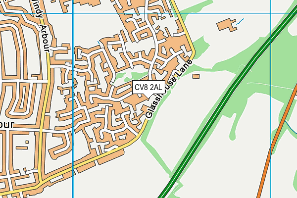
Kenilworth School and Sixth Form is located in Kenilworth and falls under the local authority of Warwickshire. This mixed-sex secondary school has 1,834 pupils, with a capacity of 2,200, aged from eleven up to nineteen, and the type of establishment is academy converter. The most recend Ofsted inspection was 8th November 2023 resulting in an outstanding rating.
| Address | Kenilworth School and Sixth Form Glasshouse Lane Kenilworth CV8 2AL |
| Website | http://ksn.org.uk/ |
| Headteacher | Mr Darren Nicholas |
GetTheData
Source: Get Information About Schools
Licence: Open Government Licence
| Phase of Education | Secondary |
| Type of Establishment | Academy converter |
| Admissions Policy | Non-selective |
| Statutory Low Age | 11 |
| Statutory High Age | 19 |
| Boarders | No boarders |
| Official Sixth Form | Has a sixth form |
| Gender | Mixed |
| Religious Character | None |
| Diocese | Not applicable |
| Special Classes | No Special Classes |
GetTheData
Source: Get Information About Schools
Licence: Open Government Licence
| Census Date | 19th January 2023 | |
| School Capacity | 2,200 | |
| Number of Pupils | 1,834 | 83% capacity |
| Number of Boys | 938 | 51% |
| Number of Girls | 896 | 49% |
| Free School Meals (%) | 8.60% |
GetTheData
Source: Get Information About Schools
Licence: Open Government Licence
| Street Address | Glasshouse Lane |
| Town | Kenilworth |
| Postcode | CV8 2AL |
| ➜ More CV8 2AL open data | |
GetTheData
Source: Get Information About Schools
Licence: Open Government Licence

GetTheData
Source: OS VectorMap District (Ordnance Survey)
Licence: Open Government Licence (requires attribution)
| Ofsted Last Inspection | 8th November 2023 |
| Ofsted Rating | Outstanding |
| Ofsted Special Measures | Not applicable |
GetTheData
Source: Get Information About Schools
Licence: Open Government Licence
| Establishment Name | Kenilworth School and Sixth Form |
| Establishment Number | 4236 |
| Unique Reference Number | 146697 |
| Local Authority | Warwickshire |
| Local Authority Code | 937 |
| Previous Local Authority Code | 999 |
| Government Statistical Service Local Authority Code | E10000031 |
| Government Office Region | West Midlands |
| District | Warwick |
| District Code | E07000222 |
| Ward | Kenilworth Park Hill |
| Parliamentary Constituency | Kenilworth and Southam |
| Urban/Rural Description | (England/Wales) Urban city and town |
| Middle Super Output Area | Warwick 002 |
| Lower Super Output Area | Warwick 002D |
GetTheData
Source: Get Information About Schools
Licence: Open Government Licence
| Establishment Status | Open |
| Last Changed Date | 24th January 2024 |
| Reason Establishment Opened | Academy Converter |
| Open Date | 1st January 2019 |
GetTheData
Source: Get Information About Schools
Licence: Open Government Licence
| Teenage Mothers | Not applicable |
| Child Care Facilities | Not applicable |
| Special Educational Needs (SEN) Provision in Primary Care Unit | Not applicable |
| Pupil Referral Unit (PRU) Provides for Educational and Behavioural Difficulties (EBD) | Not applicable |
| Pupil Referral Unit (PRU) Offers Tuition by Another Provider | Not applicable |
GetTheData
Source: Get Information About Schools
Licence: Open Government Licence
| Section 41 Approved | Not applicable |
GetTheData
Source: Get Information About Schools
Licence: Open Government Licence
| Trust flag | Supported by a multi-academy trust |
| Trust | KENILWORTH MULTI ACADEMY TRUST |
| School Sponsor flag | - |
GetTheData
Source: Get Information About Schools
Licence: Open Government Licence
| Federation flag | Not applicable |
GetTheData
Source: Get Information About Schools
Licence: Open Government Licence
| UK Provider Reference Number | 10082219 |
| Further Education Type | Not applicable |
GetTheData
Source: Get Information About Schools
Licence: Open Government Licence
| Easting | 430077 |
| Northing | 272092 |
| Latitude | 52.34608 |
| Longitude | -1.55991 |
GetTheData
Source: Get Information About Schools
Licence: Open Government Licence
| School | Phase of Education | Distance |
|---|---|---|
| Park Hill Junior School Parkfield Drive, Kenilworth, CV8 2JJ | Primary | 322m |
| Thorns Community Infant School Blackthorn Road, Kenilworth, CV8 2DS | Primary | 759m |
| St Nicholas CofE Primary School Priory Road, Kenilworth, CV8 2PE | Primary | 1.1km |
| Kenilworth Nursery School & Early Years Training Centre Bertie Road, Kenilworth, CV8 1JP | Nursery | 1.1km |
| Crackley Hall School St Joseph's Park, Coventry Road, Kenilworth, CV8 2FT | Not applicable | 1.1km |
| St John's Primary School Mortimer Road, Kenilworth, CV8 1FS | Primary | 1.8km |
| St Augustine's Catholic Primary School Hollis Lane, Kenilworth, CV8 2JY | Primary | 2km |
| Clinton Primary School Caesar Road, Kenilworth, CV8 1DL | Primary | 2km |
| Priors Field Primary School Clinton Lane, Kenilworth, CV8 1BA | Primary | 2.6km |
| Woodfield Stoneleigh Road, Coventry, CV4 7AB | Not applicable | 2.6km |
GetTheData
Source: Get Information About Schools
Licence: Open Government Licence