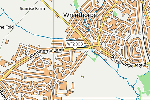
Hall Cliffe Primary School is located in Wrenthorpe, Wakefield and falls under the local authority of Wakefield. This mixed-sex school has 34 pupils, with a capacity of 34, aged from five up to thirteen, and the type of establishment is other independent special school. The most recend Ofsted inspection was 28th March 2019 resulting in an good rating.
| Address | Hall Cliffe Primary School 7 Wrenthorpe Lane Wrenthorpe Wakefield West Yorkshire WF2 0QB |
| Website | http://www.witherslackgroup.co.uk/our-locations/our-schools/hall-cliffe-primary-school/ |
| Headteacher | Mrs Claire Traynor |
GetTheData
Source: Get Information About Schools
Licence: Open Government Licence
| Phase of Education | Not applicable |
| Type of Establishment | Other independent special school |
| Admissions Policy | Not applicable |
| Statutory Low Age | 5 |
| Statutory High Age | 13 |
| Boarders | Not applicable |
| Boarding Establishment | Does not have boarders |
| Official Sixth Form | Not applicable |
| Gender | Mixed |
| Religious Character | None |
| Diocese | Not applicable |
| Special Classes | Not applicable |
GetTheData
Source: Get Information About Schools
Licence: Open Government Licence
| Census Date | 20th January 2022 | |
| School Capacity | 34 | |
| Number of Pupils | 34 | 100% capacity |
| Number of Boys | 30 | 88% |
| Number of Girls | 4 | 12% |
| Free School Meals (%) | 0.0% |
GetTheData
Source: Get Information About Schools
Licence: Open Government Licence
| Street Address | 7 Wrenthorpe Lane |
| Locality | Wrenthorpe |
| Town | Wakefield |
| County | West Yorkshire |
| Postcode | WF2 0QB |
| ➜ More WF2 0QB open data | |
GetTheData
Source: Get Information About Schools
Licence: Open Government Licence

GetTheData
Source: OS VectorMap District (Ordnance Survey)
Licence: Open Government Licence (requires attribution)
| Ofsted Last Inspection | 28th March 2019 |
| Ofsted Rating | Good |
| Ofsted Special Measures | Not applicable |
GetTheData
Source: Get Information About Schools
Licence: Open Government Licence
| Establishment Name | Hall Cliffe Primary School |
| Establishment Number | 6004 |
| Unique Reference Number | 142674 |
| Local Authority | Wakefield |
| Local Authority Code | 384 |
| Previous Local Authority Code | 999 |
| Government Statistical Service Local Authority Code | E08000036 |
| Government Office Region | Yorkshire and the Humber |
| District | Wakefield |
| District Code | E08000036 |
| Ward | Wrenthorpe and Outwood West |
| Parliamentary Constituency | Morley and Outwood |
| Urban/Rural Description | (England/Wales) Urban major conurbation |
| Middle Super Output Area | Wakefield 014 |
| Lower Super Output Area | Wakefield 014E |
GetTheData
Source: Get Information About Schools
Licence: Open Government Licence
| Establishment Status | Open |
| Last Changed Date | 28th November 2023 |
| Reason Establishment Opened | New Provision |
| Open Date | 25th February 2016 |
GetTheData
Source: Get Information About Schools
Licence: Open Government Licence
| Teenage Mothers | Not applicable |
| Special Educational Needs (SEN) Provision in Primary Care Unit | Not applicable |
| Pupil Referral Unit (PRU) Provides for Educational and Behavioural Difficulties (EBD) | Not applicable |
GetTheData
Source: Get Information About Schools
Licence: Open Government Licence
| Section 41 Approved | Not approved |
GetTheData
Source: Get Information About Schools
Licence: Open Government Licence
| Trust flag | Not applicable |
| School Sponsor flag | Not applicable |
GetTheData
Source: Get Information About Schools
Licence: Open Government Licence
| Federation flag | Not applicable |
GetTheData
Source: Get Information About Schools
Licence: Open Government Licence
| UK Provider Reference Number | 10073531 |
GetTheData
Source: Get Information About Schools
Licence: Open Government Licence
| Easting | 431214 |
| Northing | 422478 |
| Latitude | 53.69781 |
| Longitude | -1.52871 |
GetTheData
Source: Get Information About Schools
Licence: Open Government Licence
| School | Phase of Education | Distance |
|---|---|---|
| Jerry Clay Academy Jerry Clay Lane, Wrenthorpe, Wakefield, WF2 0NP | Primary | 212m |
| Silcoates School Silcoates Lane, Wrenthorpe, Wakefield, West Yorkshire, WF2 0PD | Not applicable | 376m |
| Pinderfields Hospital PRU The Wrenthorpe Centre, Imperial Avenue, Wrenthorpe, Wakefield, WF2 0LW | Not applicable | 594m |
| Wrenthorpe Academy Imperial Avenue, Wrenthorpe, Wakefield, WF2 0LW | Primary | 633m |
| Alverthorpe St Paul's CofE (VA) School 3-11yrs St Paul's Drive, Alverthorpe, Wakefield, WF2 0BT | Primary | 764m |
| Wakefield Flanshaw Junior and Infant School Flanshaw Road, Flanshaw, Wakefield, WF2 0AS | Primary | 1.4km |
| Outwood Primary Academy Kirkhamgate Brandy Carr Road, Kirkhamgate, Wakefield, WF2 0RS | Primary | 1.5km |
| Outwood Grange Academy Potovens Lane, Outwood, Wakefield, WF1 2PF | Secondary | 1.6km |
| Wakefield St Johns Church of England Voluntary Aided Junior and Infant School Belgravia Road, Wakefield, WF1 3JP | Primary | 1.7km |
| Newton Hill Community School Leeds Road, Newton Hill, Wakefield, WF1 2HR | Primary | 1.8km |
GetTheData
Source: Get Information About Schools
Licence: Open Government Licence