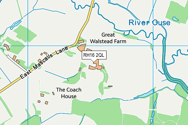
Great Walstead School is located in Lindfield, Haywards Heath and falls under the local authority of West Sussex. The school's religious denomination is Christian. This mixed-sex school has 337 pupils, with a capacity of 450, aged from two up to thirteen, and the type of establishment is other independent school.
| Address | Great Walstead School East Mascalls Lane Lindfield Haywards Heath West Sussex RH16 2QL |
| Website | http://www.greatwalstead.co.uk |
| Headteacher | Mr Christopher Calvey |
GetTheData
Source: Get Information About Schools
Licence: Open Government Licence
| Phase of Education | Not applicable |
| Type of Establishment | Other independent school |
| Admissions Policy | Non-selective |
| Statutory Low Age | 2 |
| Statutory High Age | 13 |
| Boarders | No boarders |
| Boarding Establishment | Has boarders |
| Official Sixth Form | Does not have a sixth form |
| Gender | Mixed |
| Religious Character | Christian |
| Diocese | Not applicable |
| Special Classes | Has Special Classes |
GetTheData
Source: Get Information About Schools
Licence: Open Government Licence
| Census Date | 20th January 2022 | |
| School Capacity | 450 | |
| Number of Pupils | 337 | 75% capacity |
| Number of Boys | 181 | 54% |
| Number of Girls | 156 | 46% |
| Free School Meals (%) | 0.0% |
GetTheData
Source: Get Information About Schools
Licence: Open Government Licence
| Street Address | East Mascalls Lane |
| Locality | Lindfield |
| Town | Haywards Heath |
| County | West Sussex |
| Postcode | RH16 2QL |
| ➜ More RH16 2QL open data | |
GetTheData
Source: Get Information About Schools
Licence: Open Government Licence

GetTheData
Source: OS VectorMap District (Ordnance Survey)
Licence: Open Government Licence (requires attribution)
| Ofsted Special Measures | Not applicable |
GetTheData
Source: Get Information About Schools
Licence: Open Government Licence
| Establishment Name | Great Walstead School |
| Establishment Number | 6203 |
| Unique Reference Number | 126135 |
| Local Authority | West Sussex |
| Local Authority Code | 938 |
| Previous Local Authority Code | 999 |
| Government Statistical Service Local Authority Code | E10000032 |
| Government Office Region | South East |
| District | Mid Sussex |
| District Code | E07000228 |
| Ward | Lindfield Rural & High Weald |
| Parliamentary Constituency | Mid Sussex |
| Urban/Rural Description | (England/Wales) Rural hamlet and isolated dwellings |
| Middle Super Output Area | Mid Sussex 008 |
| Lower Super Output Area | Mid Sussex 008C |
GetTheData
Source: Get Information About Schools
Licence: Open Government Licence
| Establishment Status | Open |
| Last Changed Date | 6th December 2023 |
| Reason Establishment Opened | Not applicable |
| Open Date | 1st January 1944 |
| Reason Establishment Closed | Not applicable |
GetTheData
Source: Get Information About Schools
Licence: Open Government Licence
| Teenage Mothers | Not applicable |
| Child Care Facilities | Not applicable |
| Special Educational Needs (SEN) Provision in Primary Care Unit | Not applicable |
| Pupil Referral Unit (PRU) Provides for Educational and Behavioural Difficulties (EBD) | Not applicable |
| Pupil Referral Unit (PRU) Offers Tuition by Another Provider | Not applicable |
GetTheData
Source: Get Information About Schools
Licence: Open Government Licence
| Section 41 Approved | Not approved |
GetTheData
Source: Get Information About Schools
Licence: Open Government Licence
| Trust flag | Not applicable |
| School Sponsor flag | Not applicable |
GetTheData
Source: Get Information About Schools
Licence: Open Government Licence
| Federation flag | Not applicable |
GetTheData
Source: Get Information About Schools
Licence: Open Government Licence
| UK Provider Reference Number | 10018789 |
| Further Education Type | Not applicable |
GetTheData
Source: Get Information About Schools
Licence: Open Government Licence
| Easting | 536563 |
| Northing | 124853 |
| Latitude | 51.00686 |
| Longitude | -0.05488 |
GetTheData
Source: Get Information About Schools
Licence: Open Government Licence
| School | Phase of Education | Distance |
|---|---|---|
| St Augustine's CofE Primary School Vicarage Lane, Scaynes Hill, Haywards Heath, RH17 7PB | Primary | 1.5km |
| Lindfield Primary Academy School Lane, Lindfield, Haywards Heath, RH16 2DX | Primary | 2.1km |
| Northlands Wood Primary Academy Beech Hill, Haywards Heath, RH16 3RX | Primary | 2.2km |
| Blackthorns Community Primary Academy 3 Blackthorns Close, Lindfield, Haywards Heath, RH16 2UA | Primary | 2.3km |
| Oathall Community College Appledore Gardens, Lindfield, Haywards Heath, RH16 2AQ | Secondary | 2.6km |
| St Wilfrid's CofE Primary School Eastern Road, Haywards Heath, RH16 3NL | Primary | 2.9km |
| Warden Park Primary Academy New England Road, Haywards Heath, RH16 3JR | Primary | 3.1km |
| Chalkhill Education Centre, Chalkhill Hospital Chalkhill, Princess Royal Hospital Site, Lewes Road, Haywards Heath, RH16 4NQ | Not applicable | 3.2km |
| St Joseph's Catholic Primary School Hazelgrove Road, Haywards Heath, RH16 3PQ | Primary | 3.3km |
| Central Education Ltd Yew Tree Farm, Nash Lane, Scaynes Hill, Haywards Heath, RH17 7NJ | Not applicable | 3.6km |
GetTheData
Source: Get Information About Schools
Licence: Open Government Licence