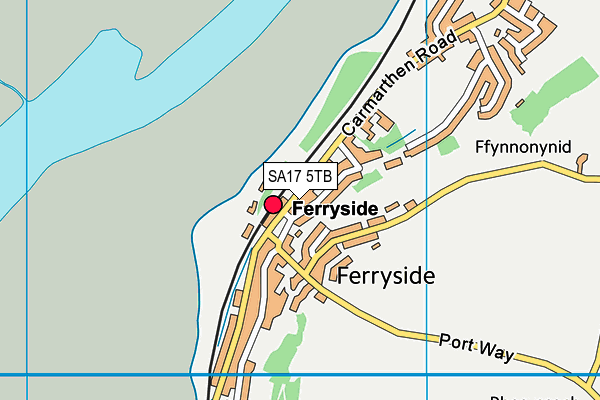
Ferryside VCP is located in Carmarthenshire and falls under the local authority of Carmarthenshire. The type of establishment is welsh establishment.
| Address | Ferryside VCP Ferryside Carmarthenshire SA17 5TB |
GetTheData
Source: Get Information About Schools
Licence: Open Government Licence
| Phase of Education | Not applicable |
| Type of Establishment | Welsh establishment |
| Boarders | Not applicable |
| Official Sixth Form | Not applicable |
| Gender | Not applicable |
| Diocese | Not applicable |
| Special Classes | Not applicable |
GetTheData
Source: Get Information About Schools
Licence: Open Government Licence
| Street Address | Ferryside |
| Town | Carmarthenshire |
| Postcode | SA17 5TB |
| ➜ More SA17 5TB open data | |
GetTheData
Source: Get Information About Schools
Licence: Open Government Licence

GetTheData
Source: OS VectorMap District (Ordnance Survey)
Licence: Open Government Licence (requires attribution)
| Ofsted Special Measures | Not applicable |
GetTheData
Source: Get Information About Schools
Licence: Open Government Licence
| Establishment Name | Ferryside VCP |
| Establishment Number | 3013 |
| Unique Reference Number | 400849 |
| Local Authority | Carmarthenshire |
| Local Authority Code | 669 |
| Previous Local Authority Code | 999 |
| Government Statistical Service Local Authority Code | W06000010 |
| Government Office Region | Wales (pseudo) |
| District | Carmarthenshire |
| District Code | W06000010 |
| Ward | Kidwelly and St Ishmael |
| Parliamentary Constituency | Carmarthen East and Dinefwr |
| Urban/Rural Description | (England/Wales) Rural village in a sparse setting |
| Middle Super Output Area | Carmarthenshire 012 |
| Lower Super Output Area | Carmarthenshire 012E |
GetTheData
Source: Get Information About Schools
Licence: Open Government Licence
| Establishment Status | Open |
| Last Changed Date | 13th June 2022 |
| Reason Establishment Opened | Not applicable |
| Reason Establishment Closed | Not applicable |
GetTheData
Source: Get Information About Schools
Licence: Open Government Licence
| Teenage Mothers | Not applicable |
| Child Care Facilities | Not applicable |
| Special Educational Needs (SEN) Provision in Primary Care Unit | Not applicable |
| Pupil Referral Unit (PRU) Provides for Educational and Behavioural Difficulties (EBD) | Not applicable |
| Pupil Referral Unit (PRU) Offers Tuition by Another Provider | Not applicable |
GetTheData
Source: Get Information About Schools
Licence: Open Government Licence
| Section 41 Approved | Not approved |
GetTheData
Source: Get Information About Schools
Licence: Open Government Licence
| Trust flag | Not applicable |
| School Sponsor flag | Not applicable |
GetTheData
Source: Get Information About Schools
Licence: Open Government Licence
| Federation flag | Not applicable |
GetTheData
Source: Get Information About Schools
Licence: Open Government Licence
| Further Education Type | Not applicable |
GetTheData
Source: Get Information About Schools
Licence: Open Government Licence
| Easting | 236684 |
| Northing | 210437 |
| Latitude | 51.76872 |
| Longitude | -4.36826 |
GetTheData
Source: Get Information About Schools
Licence: Open Government Licence
| School | Phase of Education | Distance |
|---|---|---|
| Ysgol Llanstephan Llanstephan, Carmarthenshire, SA33 5LN | Not applicable | 1.5km |
| Ysgol Gwenllian Cydweli, Sir Gaerfyrddin, SA17 4UT | Not applicable | 5.4km |
| Llangain School Llangain, Carmarthenshire, SA33 5AE | Not applicable | 5.5km |
| Ysgol Y Castell Priory Street, Kidwelly, Carmarthenshire, SA17 4TR | Not applicable | 5.7km |
| Ysgol G. Mynyddygarreg Mynyddygarreg, Kidwelly, Carmarthenshire, SA17 4RL | Not applicable | 6.6km |
| Laugharne V.C.P. School Orchard Park, Laugharne, Carmarthenshire, SA33 4TE | Not applicable | 6.9km |
| Ysgol Gyfun Gymraeg Bro Myrddin Croesyceiliog, Caerfyrddin, Sir Gaerfyrddin, SA32 8DN | Not applicable | 8.5km |
| Carmarthenshire Secondary Teaching and Learning Centre Carmarthen Llansteffan Road, Johnstown, Carmarthen, SA31 3NQ | Not applicable | 8.7km |
| Bancyfelin C.P. School Bancyfelin, Carmarthenshire, SA33 5ND | Not applicable | 8.8km |
| Queen Elizabeth High Llansteffan Road, Johnstown Road, Carmarthenshire, SA31 3NL | Not applicable | 9.1km |
GetTheData
Source: Get Information About Schools
Licence: Open Government Licence