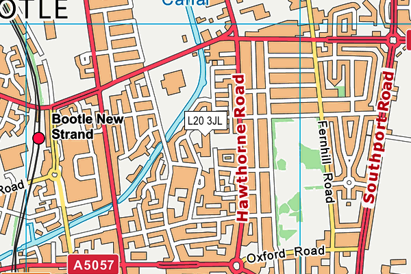
Christ Church Church of England Controlled Primary School is located in Waterworks Street, Bootle and falls under the local authority of Sefton. The school's religious denomination is Church of England. This mixed-sex primary school has 440 pupils, with a capacity of 450, aged from two up to eleven, and the type of establishment is voluntary controlled school. The school has 20 teachers with each teacher on average earning the full-time equivalent of £34,406. The most recend Ofsted inspection was 30th June 2023 resulting in an good rating.
| Address | Christ Church Church of England Controlled Primary School Brookhill Road Waterworks Street Bootle Merseyside L20 3JL |
| Website | http://www.christchurchce.co.uk/ |
| Headteacher | Miss Lynsey Gregory |
GetTheData
Source: Get Information About Schools
Licence: Open Government Licence
| Phase of Education | Primary |
| Type of Establishment | Voluntary controlled school |
| Admissions Policy | Not applicable |
| Statutory Low Age | 2 |
| Statutory High Age | 11 |
| Boarders | No boarders |
| Official Sixth Form | Does not have a sixth form |
| Gender | Mixed |
| Religious Character | Church of England |
| Diocese | Diocese of Liverpool |
| Special Classes | No Special Classes |
GetTheData
Source: Get Information About Schools
Licence: Open Government Licence
| Census Date | 19th January 2023 | |
| School Capacity | 450 | |
| Number of Pupils | 440 | 98% capacity |
| Number of Boys | 239 | 54% |
| Number of Girls | 201 | 46% |
| Free School Meals (%) | 52.40% |
GetTheData
Source: Get Information About Schools
Licence: Open Government Licence
| Street Address | Brookhill Road |
| Locality | Waterworks Street |
| Town | Bootle |
| County | Merseyside |
| Postcode | L20 3JL |
| ➜ More L20 3JL open data | |
GetTheData
Source: Get Information About Schools
Licence: Open Government Licence

GetTheData
Source: OS VectorMap District (Ordnance Survey)
Licence: Open Government Licence (requires attribution)
| Ofsted Last Inspection | 30th June 2023 |
| Ofsted Rating | Good |
| Ofsted Special Measures | Not applicable |
GetTheData
Source: Get Information About Schools
Licence: Open Government Licence
| Total Number of Teachers | 20 |
| Total Number of Teachers (Full-Time Equivalent) | 18.8 |
| Total Number of Teaching Assistants | 16 |
| Total Number of Teaching Assistants (Full-Time Equivalent) | 13.7 |
| Total Number of Non Classroom-based School Support Staff | 4 |
| Total Number of Non Classroom-based School Support Staff (Full-Time Equivalent) | 4 |
| Pupil:Teacher Ratio | 17.6 |
| Mean Gross Full-Time Equivalent Salary of All Teachers | £34,406 |
GetTheData
Source: Department for Education: School Performance Tables
Licence: Open Government Licence
| Establishment Name | Christ Church Church of England Controlled Primary School |
| Establishment Number | 3000 |
| Unique Reference Number | 104893 |
| Local Authority | Sefton |
| Local Authority Code | 343 |
| Previous Local Authority Code | 999 |
| Government Statistical Service Local Authority Code | E08000014 |
| Government Office Region | North West |
| District | Sefton |
| District Code | E08000014 |
| Ward | Derby |
| Parliamentary Constituency | Bootle |
| Urban/Rural Description | (England/Wales) Urban major conurbation |
| Middle Super Output Area | Sefton 038 |
| Lower Super Output Area | Sefton 038F |
GetTheData
Source: Get Information About Schools
Licence: Open Government Licence
| Establishment Status | Open |
| Last Changed Date | 10th January 2024 |
| Reason Establishment Opened | Not applicable |
| Reason Establishment Closed | Not applicable |
GetTheData
Source: Get Information About Schools
Licence: Open Government Licence
| Teenage Mothers | Not applicable |
| Child Care Facilities | Not applicable |
| Special Educational Needs (SEN) Provision in Primary Care Unit | Not applicable |
| Pupil Referral Unit (PRU) Provides for Educational and Behavioural Difficulties (EBD) | Not applicable |
| Pupil Referral Unit (PRU) Offers Tuition by Another Provider | Not applicable |
GetTheData
Source: Get Information About Schools
Licence: Open Government Licence
| Section 41 Approved | Not applicable |
GetTheData
Source: Get Information About Schools
Licence: Open Government Licence
| Trust flag | Not applicable |
| School Sponsor flag | Not applicable |
GetTheData
Source: Get Information About Schools
Licence: Open Government Licence
| Federation flag | Not under a federation |
GetTheData
Source: Get Information About Schools
Licence: Open Government Licence
| UK Provider Reference Number | 10071405 |
| Further Education Type | Not applicable |
GetTheData
Source: Get Information About Schools
Licence: Open Government Licence
| Easting | 334657 |
| Northing | 395584 |
| Latitude | 53.45294 |
| Longitude | -2.98545 |
GetTheData
Source: Get Information About Schools
Licence: Open Government Licence
| School | Phase of Education | Distance |
|---|---|---|
| St Monica's Catholic Primary School Kelly Drive, Bootle, L20 9EB | Primary | 737m |
| Bedford Primary School Quarry Road, Bootle, Liverpool, L20 9LJ | Primary | 738m |
| Cambridge Nursery School Cambridge Road, Bootle, Bootle, L20 9LQ | Nursery | 793m |
| Linacre Primary School Thornton Road, Bootle, L20 5ED | Primary | 806m |
| All Saints Catholic Primary School Chesnut Grove, Bootle, L20 4LX | Primary | 847m |
| Hillside High School Breeze Hill, Bootle, L20 9NU | Secondary | 850m |
| Hugh Baird College Balliol Road, Bootle, L20 7EW | 16 plus | 914m |
| Thomas Gray Primary School Chestnut Grove, Bootle, L20 4LX | Primary | 934m |
| Greenacre Community Nursery School Province Place, Bootle, L20 6PJ | Nursery | 996m |
| King's Leadership Academy Hawthornes Fernhill Road, Bootle, L20 6AQ | Secondary | 1.2km |
GetTheData
Source: Get Information About Schools
Licence: Open Government Licence