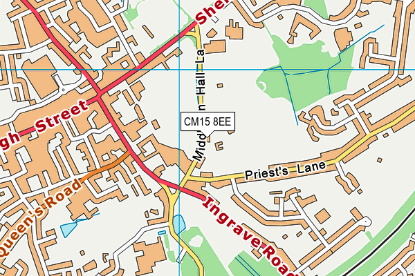
Brentwood School is located in Brentwood and falls under the local authority of Essex. The school's religious denomination is Christian. This mixed-sex school has 1,946 pupils, with a capacity of 2,000, aged from three up to nineteen, and the type of establishment is other independent school.
| Address | Brentwood School Middleton Hall Lane Brentwood Essex CM15 8EE |
| Website | http://www.brentwoodschool.co.uk |
| Headteacher | Mr Michael Bond |
GetTheData
Source: Get Information About Schools
Licence: Open Government Licence
| Phase of Education | Not applicable |
| Type of Establishment | Other independent school |
| Admissions Policy | Not applicable |
| Statutory Low Age | 3 |
| Statutory High Age | 19 |
| Boarders | Boarding school |
| Boarding Establishment | Has boarders |
| Official Sixth Form | Has a sixth form |
| Gender | Mixed |
| Religious Character | Christian |
| Diocese | Not applicable |
| Special Classes | No Special Classes |
GetTheData
Source: Get Information About Schools
Licence: Open Government Licence
| Census Date | 20th January 2022 | |
| School Capacity | 2,000 | |
| Number of Pupils | 1,946 | 97% capacity |
| Number of Boys | 1,084 | 56% |
| Number of Girls | 862 | 44% |
GetTheData
Source: Get Information About Schools
Licence: Open Government Licence
| Street Address | Middleton Hall Lane |
| Town | Brentwood |
| County | Essex |
| Postcode | CM15 8EE |
| ➜ More CM15 8EE open data | |
GetTheData
Source: Get Information About Schools
Licence: Open Government Licence

GetTheData
Source: OS VectorMap District (Ordnance Survey)
Licence: Open Government Licence (requires attribution)
| Ofsted Special Measures | Not applicable |
GetTheData
Source: Get Information About Schools
Licence: Open Government Licence
| Establishment Name | Brentwood School |
| Establishment Number | 6035 |
| Previous Establishment Number | 6229 |
| Unique Reference Number | 115429 |
| Local Authority | Essex |
| Local Authority Code | 881 |
| Previous Local Authority | Pre LGR (1998) Essex |
| Previous Local Authority Code | 915 |
| Government Statistical Service Local Authority Code | E10000012 |
| Government Office Region | East of England |
| District | Brentwood |
| District Code | E07000068 |
| Ward | Brentwood South |
| Parliamentary Constituency | Brentwood and Ongar |
| Urban/Rural Description | (England/Wales) Urban city and town |
| Middle Super Output Area | Brentwood 008 |
| Lower Super Output Area | Brentwood 008A |
GetTheData
Source: Get Information About Schools
Licence: Open Government Licence
| Establishment Status | Open |
| Last Changed Date | 28th November 2023 |
| Reason Establishment Opened | Not applicable |
| Open Date | 30th September 1980 |
| Reason Establishment Closed | Not applicable |
GetTheData
Source: Get Information About Schools
Licence: Open Government Licence
| Teenage Mothers | Not applicable |
| Child Care Facilities | Not applicable |
| Special Educational Needs (SEN) Provision in Primary Care Unit | Not applicable |
| Pupil Referral Unit (PRU) Provides for Educational and Behavioural Difficulties (EBD) | Not applicable |
| Pupil Referral Unit (PRU) Offers Tuition by Another Provider | Not applicable |
GetTheData
Source: Get Information About Schools
Licence: Open Government Licence
| Section 41 Approved | Not approved |
GetTheData
Source: Get Information About Schools
Licence: Open Government Licence
| Trust flag | Not applicable |
| School Sponsor flag | Not applicable |
GetTheData
Source: Get Information About Schools
Licence: Open Government Licence
| Federation flag | Not applicable |
GetTheData
Source: Get Information About Schools
Licence: Open Government Licence
| UK Provider Reference Number | 10015255 |
| Further Education Type | Not applicable |
GetTheData
Source: Get Information About Schools
Licence: Open Government Licence
| Easting | 560094 |
| Northing | 194079 |
| Latitude | 51.62276 |
| Longitude | 0.3113 |
GetTheData
Source: Get Information About Schools
Licence: Open Government Licence
| School | Phase of Education | Distance |
|---|---|---|
| St Thomas of Canterbury Church of England Aided Primary School, Brentwood Sawyers Hall Lane, Brentwood, CM15 9BX | Primary | 608m |
| Hogarth Primary School Riseway, Brentwood, CM15 8BG | Primary | 721m |
| Brentwood Ursuline Convent High School Queen's Road, Brentwood, CM14 4EX | Secondary | 732m |
| Brentwood County High School Seven Arches Road, Brentwood, CM14 4JF | Secondary | 758m |
| Becket Keys Church of England Free School Sawyers Hall Lane, Brentwood, CM15 9DA | Secondary | 793m |
| Endeavour Co-Operative Academy Hogarth Avenue, Brentwood, CM15 8BE | Not applicable | 795m |
| Grove House School Sawyers Hall Lane, Brentwood, CM15 9DA | Not applicable | 817m |
| St Helen's Catholic Junior School Sawyers Hall Lane, Brentwood, CM15 9BY | Primary | 849m |
| St Helen's Catholic Infant School Sawyers Hall Lane, Brentwood, CM15 9BY | Primary | 888m |
| Shenfield St. Mary's Church of England Primary School Hall Lane, Shenfield, Brentwood, CM15 9AL | Primary | 1km |
GetTheData
Source: Get Information About Schools
Licence: Open Government Licence